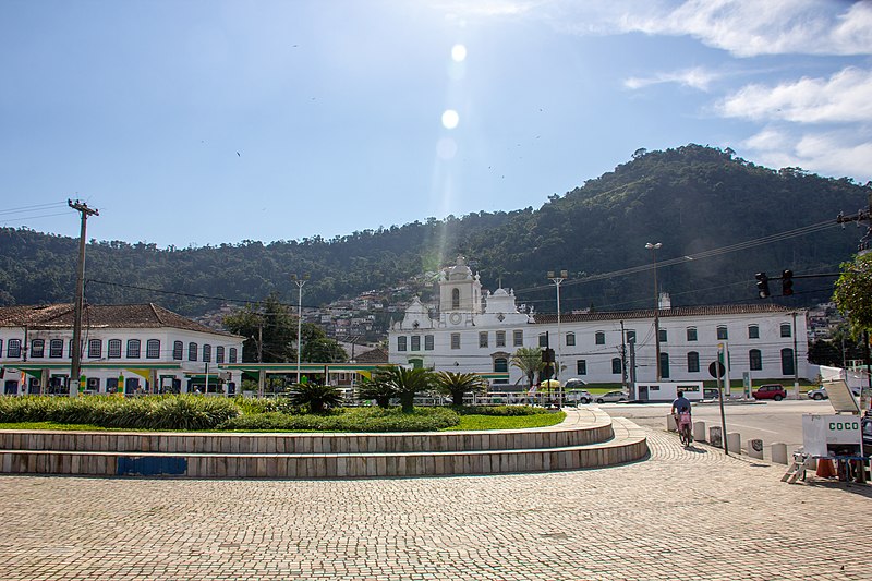
File:Angra_dos_Reis,_Brazil_2018_116.jpg · Wikimedia Commons · See Wikimedia Commons
Angra dos Reis
Sign in to savemunicipality of Rio de Janeiro state, Brazil
Key facts
- Country
- Brazil
- Region
- Southeast
- State
- Rio de Janeiro
- Founded
- 6 January 1502
- Mayor
- Fernando Jordão ( MDB )
- Total
- 816.3 km (315.2 sq mi)
- Elevation
- 5.78 m (19.0 ft)
- Estimate 2025
- 179,142
- Density
- 205.1/km (531.2/sq mi)
- Demonym
- angrense
- Time zone
- UTC−3 ( BRT )
- Hdi 2010
- 0.724 – high
- Website
- angra .rj .gov .br
via Wikipedia infobox
Wikidata facts
- Instance of
- big city
- Official name
- Angra dos Reis
- Demonym
- angrense
- Country
- Brazil
- Located in
- Rio de Janeiro
- Population
- 85571
- Area
- 800.430
- Elevation
- 6
- Time zone
- UTC−03:00
- Shares border with
- São José do Barreiro
- Official website
- www.angra.rj.gov.br
- Image
- 1 angra dos reis panorama 2010.jpg
- Dialing code
- 24
Show 7 more facts
- topic's main category
- Category:Angra dos Reis
- Commons category
- Angra dos Reis
- Human Development Index
- 0.724
- inception
- 1556-01-01
- postal code
- 23.900-000
- short name
- Angra
- electorate
- 131085
Sources (6)
via Wikidata · CC0
~5 min read
Encyclopedic overview
Angra dos Reis ( Portuguese pronunciation: [ˈɐ̃ɡɾɐ duʒ ˈʁejʃ]; Portuguese for cove or bay of the Kings) is a municipality located in the southern part of the Brazilian state of Rio de Janeiro. The city is located by the sea and includes in its territory many offshore islands, the largest being Ilha Grande.
The area was first documented by Europeans on January 6, 1502, and has been under continual settlement since 1556. Its population was in the 2022 Census 167,434 inhabitants.
Excerpted from Wikipedia’s “Angra dos Reis” article, available under the CC BY-SA 4.0 licence.