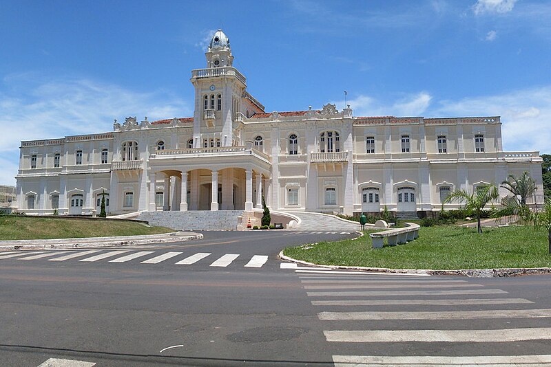
File:Prefeitura_de_Araguari.jpg · Wikimedia Commons · See Wikimedia Commons
Araguari
Sign in to saveIn the Vinony graph
Within Vinony's link graph, Araguari is referenced by 724 other articles, and connects out to Brazil, list of sovereign states and time zone.
The entry is geolocated on the map in BR, across 2 mapped points.
It is catalogued under the topic Municipalities in Minas Gerais.
Its subject is documented across 36 Wikipedia language editions.
Key facts
- Settlement.name
- Araguari
- Settlement.settlement_type
- Municipality
- Settlement.official_name
- Municipality of Araguari
- Settlement.nickname
- Cidade Sorriso
- Settlement.image_skyline
- Prefeitura de Araguari.jpg
- Settlement.image_flag
- Bandeira-araguari-certa.jpg
- Settlement.image_seal
- Brasao_Araguari.jpg
- Settlement.pushpin_map
- Brazil
- Settlement.pushpin_map_caption
- Location in Brazil
- Settlement.image_map
- MinasGerais Municip Araguari.svg
- Settlement.map_caption
- Location in Minas Gerais
- Settlement.subdivision_type
- Country
- Settlement.subdivision_type1
- Region
- Settlement.subdivision_type2
- State
- Settlement.subdivision_name1
- Southeast
- Settlement.leader_title
- Mayor
- Settlement.leader_name
- Renato Carvalho Fernandes
- Settlement.established_title
- Founded
via Wikipedia infobox
Wikidata facts
- Instance of
- big city
- Demonym
- araguarino
- Country
- Brazil
- Located in
- Minas Gerais
- Population
- 91283
- Area
- 1054.3
- Elevation
- 1013
- Time zone
- UTC−03:00
- Shares border with
- Catalão
- Official website
- www.araguari.mg.gov.br
- Image
- Prefeitura de Araguari.jpg
- Dialing code
- 034
Show 5 more facts
- Commons category
- Araguari
- Human Development Index
- 0.815
- inception
- 1888-00-00
- postal code
- 38440-000 a 38459-999
- electorate
- 88896
via Wikidata · CC0
~8 min read
Encyclopedic overview
20 sectionsContents
- Geography
- Rivers
- Climate
- Distances from major cities
- Main highways serving the municipality
- Demographics
- Economy
- Occupation of the population by sectors
- Enterprises
- Farm data for 2006
- Main permanent crops in planted area in 2006
- Main perennial crops in planted area in 2006
- Livestock raising in 2006
- Health and education
- Culture
- Tourism
- History
- See also
- References
- External links (in Portuguese)
Araguari is a municipality in western Minas Gerais state, Brazil. It is in the northern Triângulo Mineiro region, on the Jordão River, a tributary of the Paranaíba River, at an elevation between . The municipality of Araguari has an area of , with in the urban zone and in the rural zone. The population in 2020 was 117,825, making it the third-most important city in the Triângulo Mineiro, after Uberlândia and Uberaba. Araguari has also been one of the fastest-growing cities in Brazil, growing more than the rest of the country in proportion.
==Geography== ===Rivers=== Rivers that water the municipality are Rio Araguari, Ribeirão das Araras, Corrego Grande, Ribeirão Jordão, and Ribeirão Piçarrão. The Paranaíba in the north forms the boundary with the state of Goiás. There are many waterfalls and rapids (128 according to one source), giving the area a great potential in tourism.
Excerpted from Wikipedia’s “Araguari” article, available under the CC BY-SA 4.0 licence.
Gallery (6)
On the map
2 mapped locations