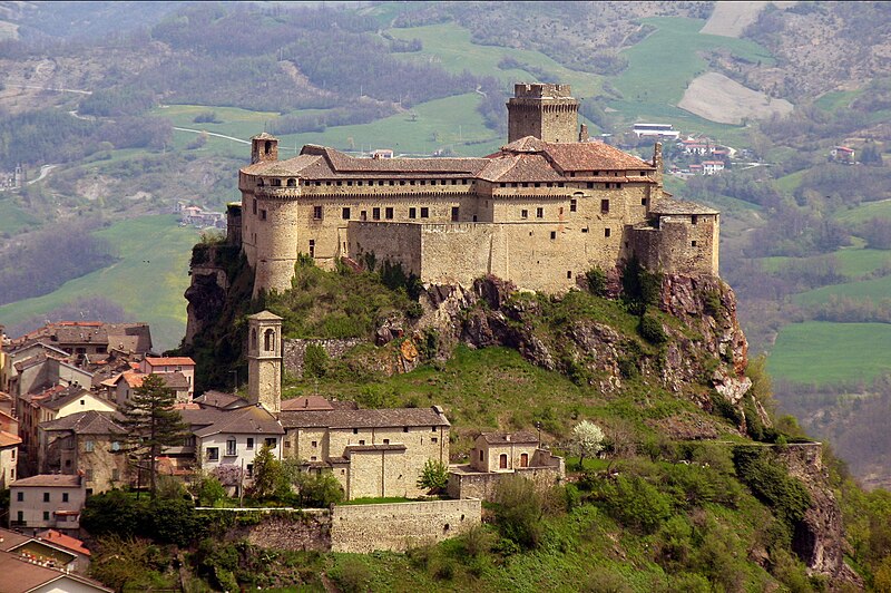
File:Bardi_il_castello.jpg · Wikimedia Commons · See Wikimedia Commons
Key facts
- Country
- Italy
- Region
- Emilia-Romagna
- Province
- Parma (PR)
- Mayor
- Valentina Pontremoli
- Total
- 190.1 km (73.4 sq mi)
- Elevation
- 625 m (2,051 ft)
- Density
- 10.49/km (27.17/sq mi)
- Demonym
- Bardigiani
- Time zone
- UTC+1 ( CET )
- Summer dst
- UTC+2 ( CEST )
- Dialing code
- 0525
- Patron saint
- St. John the Baptist
- Saint day
- June 24
- Website
- Official website
via Wikipedia infobox
Official website
Link to the official site · 5,635 chars · not written by Vinony
Wikidata facts
- Instance of
- comune of Italy
- Official name
- Bardi
- Country
- Italy
- Located in
- Province of Parma
- Population
- 2017
- Area
- 189.9
- Elevation
- 625
- Time zone
- UTC+02:00
- Capital of
- Landi State
- Shares border with
- Morfasso
- Official website
- www.comune.bardi.pr.it
- Image
- Bardi-Castello dei Landi.jpg
- Dialing code
- 0525
- Licence plate code
- PR
- Patron saint
- John the Baptist
Show 4 more facts
- postal code
- 43032
- Commons category
- Bardi
- topic's main category
- Category:Bardi, Emilia-Romagna
- P12749
- couch
Sources (6)
via Wikidata · CC0
~3 min read
Encyclopedic overview
Bardi (Emilian: Bàrdi) is a comune (municipality) in the Province of Parma in the Italian region Emilia-Romagna, located about 130 kilometres (81 mi) west of Bologna and about 50 kilometres (31 mi) southwest of Parma, in the upper Ceno valley at the confluence of the rivers Ceno and Noveglia. It is dominated by the imposing Landi Castle [it] built over a spur of red jasper.
Bardi borders the following municipalities: Bedonia, Bore, Borgo Val di Taro, Compiano, Farini, Ferriere, Morfasso, Valmozzola, Varsi.
Excerpted from Wikipedia’s “Bardi” article, available under the CC BY-SA 4.0 licence.