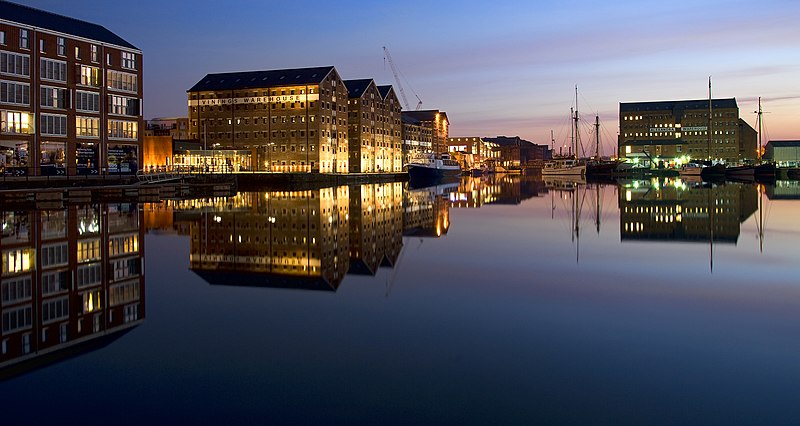
File:Gloucester_Docks_at_Night.jpeg · Wikimedia Commons · See Wikimedia Commons
Gloucester
Sign in to savestad in Verenigd Koninkrijk
OverviewAI-generated
Gloucester is a city and county town in Gloucestershire, England, within the United Kingdom. It serves as the capital of Gloucestershire and is situated next to the River Severn. The city has a population of 145,563 and covers an area of 34.5 square units. Its elevation is approximately 25 meters, and it operates in the UTC±00:00 time zone.
The local dialing code for Gloucester is 01452. The city is twinned with Metz, Trier, Gouda, and Saint Ann's Bay. Gloucester is described in sources including Brockhaus and Efron Encyclopedic Dictionary, The Nuttall Encyclopædia, Jewish Encyclopedia of Brockhaus and Efron, and Encyclopædia Britannica 11th edition.
Synthesized by Vinony from 48 facts across 7 sources: Wikidata, Open Meteo, Openweathermap, OpenStreetMap, GeoNames, Vinony graph, Geo. Generated from structured data (not the Wikipedia text) and checked against those facts — may still contain errors.
Weather now
7-day forecast
via Open-Meteo
Place details
- Locality
- Gloucester
- Region
- England
- Country
- United Kingdom
- Population
- 132,416
- Timezone
- Europe/London
via OpenStreetMap · GeoNames
Key facts
- Settlement.official_name
- Gloucester
- Settlement.settlement_type
- City and non-metropolitan district
- Settlement.image_shield
- CoA of City of Gloucester (minor).svg
- Settlement.shield_size
- 100x90px
- Settlement.image_map
- Gloucester UK locator map.svg
- Settlement.map_caption
- City of Gloucester shown within Gloucestershire
- Settlement.pushpin_label_position
- bottom
- Settlement.subdivision_type
- Sovereign state
- Settlement.subdivision_name
- United Kingdom
- Settlement.subdivision_type1
- Country
- Settlement.subdivision_name1
- England
- Settlement.subdivision_type2
- Region
- Settlement.subdivision_name2
- South West England
- Settlement.subdivision_type3
- Non-metropolitan county
- Settlement.subdivision_name3
- Gloucestershire
- Settlement.subdivision_type4
- Status
- Settlement.subdivision_name4
- Non-metropolitan district, city
- Settlement.subdivision_type5
- Admin HQ
via Wikipedia infobox
Wikidata facts
- Country
- United Kingdom
- Population
- 145563
- Area
- 34.5
- Time zone
- UTC±00:00
- Body of water
- River Severn
- Capital of
- Gloucestershire
- Official website
- www.gloucester.gov.uk
- Image
- Gloucester and its cathedral - geograph.org.uk - 1454853.jpg
- Dialing code
- 01452
Show 11 more facts
- twinned administrative body
- Saint Ann's Bay
- Commons category
- Gloucester
- topic's main category
- Category:Gloucester
- category for people born here
- Category:Births in Gloucester
- category for people who died here
- Category:Deaths in Gloucester
- category of associated people
- Category:People from Gloucester
- Commons gallery
- Gloucester
- described by source
- Encyclopædia Britannica 11th edition
- P8168
- René Fülöp-Miller
- different from
- Gloucester
- P12749
- Gerd Kanter
Sources (6)
via Wikidata · CC0
Article · Nederlands
Gloucester [´ɡlɒstə]? is een district met de officiële titel van city, in het Engelse shire-graafschap (non-metropolitan county OF county) Gloucestershire, dicht bij de grens met Wales. Het is gelegen aan de oostelijke oever van de Severn. Het is beschut door de Cotswolds in het oosten, de Forest of Dean in het westen en de Malvern Hills in het noorden. Gloucester is de 53e grootste agglomeratie in het Verenigd Koninkrijk qua bevolking met 129.000 inwoners. De oppervlakte bedraagt 41 km². Van de bevolking is 15 procent ouder dan 65 jaar. De werkloosheid bedraagt 3,4 procent van de beroepsbevolking. (cijfers volkstelling 2001). Gloucester werd in 48 door de Romeinen gesticht en werd toen Glevum genoemd. Het verkreeg haar eerste charter in 1155 van koning Hendrik II. Economisch gezien is de stad gedomineerd door dienstverlenende bedrijven, en heeft het een sterke financiële en zakelijke sector. Het is de thuisbasis van de bank Cheltenham & Gloucester en was historisch prominent in de lucht- en ruimtevaartindustrie.
Abstract from DBpedia / Wikipedia · CC BY-SA
Gallery (52)
On the map
Available in 83 languages
- Español
- Français
- Deutsch
- 中文
- 日本語
- Русский
- Português
- Italiano
- العربية
- Afrikaans
- Aragonese
- Armenian
- Asturian
- azb
- Basque
- be_x_old
- Belarusian
- Breton
Show 64 more
- Bulgarian
- Catalan
- Cebuano
- Cornish
- Czech
- Danish
- Egyptian Arabic
- Esperanto
- Estonian
- Filipino
- Finnish
- Galician
- Greek
- Hebrew
- Hungarian
- Icelandic
- Irish
- Kurdish
- Latin
- Latvian
- Lithuanian
- lld
- Lombard
- Malagasy
- Manipuri
- Marathi
- Mazanderani
- Nederlands
- Northern Frisian
- Norwegian
- Norwegian Nynorsk
- nrm
- Occitan
- Ossetic
- Piedmontese
- Polski
- Quechua
- Romanian
- Serbian
- Serbian (Latin)
- Silesian
- simple
- Slovak
- Slovenian
- Svenska
- Swahili
- Tatar
- Tiếng Việt
- Türkçe
- Ukrainian
- Urdu
- Uyghur
- Volapük
- Waray
- Welsh
- Western Panjabi
- Wu Chinese
- Yiddish
- Zaza
- zh_min_nan
- zh_yue
- فارسی
- ไทย
- 한국어
via Wikidata sitelinks · CC0