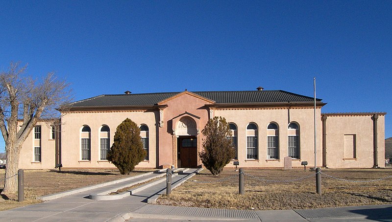
File:Hudspeth_county_courthouse_2009.jpg · Wikimedia Commons · See Wikimedia Commons
Hudspeth County
Sign in to saveAlso known as Hudspeth County, Texas, Hudspeth County, TX
county in Texas, United States
Key facts
- Country
- United States
- State
- Texas
- Named after
- Claude B. Hudspeth
- Seat
- Sierra Blanca
- Largest community
- Fort Hancock
- Total
- 4,572 sq mi (11,840 km )
- Land
- 4,571 sq mi (11,840 km )
- Water
- 0.8 sq mi (2.1 km ) 0.02%
- Estimate 2025
- 3,433
- Density
- 0.7/sq mi (0.27/km )
- Time zone
- UTC−7 ( Mountain )
- Summer dst
- UTC−6 ( MDT )
- Congressional district
- 23rd
- Website
- www .co .hudspeth .tx .us
via Wikipedia infobox
Official website
Hudspeth County, Texas
co.hudspeth.tx.us →Link to the official site · 6,670 chars · not written by Vinony
Wikidata facts
- Named after
- Claude Benton Hudspeth
- Country
- United States
- Located in
- Texas
- Contains
- Sierra Blanca
- Capital
- Sierra Blanca
- Population
- 3202
- Area
- 11841
- Shares border with
- Otero County
- Official website
- www.co.hudspeth.tx.us
- Image
- Hudspeth county courthouse 2009.jpg
- Households
- 1127
Show 6 more facts
- Commons category
- Hudspeth County, Texas
- inception
- 1917-01-01
- topic's main category
- Category:Hudspeth County, Texas
- water as percent of area
- 0.02
- native label
- Hudspeth County
- per capita income
- 13267
Sources (11)
via Wikidata · CC0
~11 min read
Encyclopedic overview
Hudspeth County is a county located in the U.S. state of Texas. As of the 2020 census, the population was 3,202. Its county seat is Sierra Blanca, and the largest community is Fort Hancock. The county is named for Claude Benton Hudspeth, a state senator and United States Representative from El Paso. It is northeast of the Mexico–U.S. border.
Hudspeth County is included in the El Paso metropolitan area. It is one of the nine counties that comprise the Trans-Pecos region of West Texas. Hudspeth County is one of two Texas counties to entirely observe Mountain Time, along with neighboring El Paso County, while Culberson County partly observes it (in the northwestern region, as the rest of the county observes Central Time).
Excerpted from Wikipedia’s “Hudspeth County” article, available under the CC BY-SA 4.0 licence.