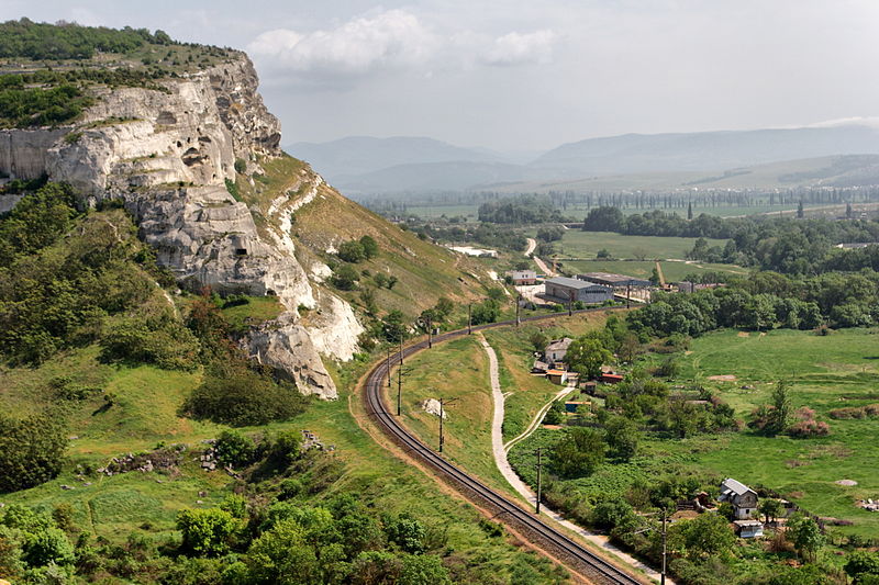
File:Inkerman_33_(8709967741).jpg · Wikimedia Commons · See Wikimedia Commons
Key facts
- Settlement.settlement_type
- City
- Settlement.subdivision_type
- Country
- Settlement.subdivision_name
- Disputed:
- Settlement.subdivision_type1
- Autonomous republic
- Settlement.subdivision_name1
- Crimea (de jure)
- Settlement.timezone
- MSK
- Settlement.utc_offset
- +4
- Settlement.official_name
- Inkerman
- Settlement.image_skyline
- Inkerman_33_(8709967741).jpg
- Settlement.image_caption
- The urban areas on the west bank of the Chorna River have been converted into rural settlements
- Settlement.image_shield
- COA Inkerman, Sevastopol.svg
- Settlement.image_flag
- FLA Inkerman, Sevastopol, Ukraine.svg
- Settlement.pushpin_map
- Crimea
- Settlement.pushpin_map_caption
- Location of Inkerman within Crimea
- Settlement.elevation_m
- 50
- Settlement.population_total
- 10348
- Settlement.population_as_of
- 2014
- Settlement.postal_code_type
- Postal code
via Wikipedia infobox
Wikidata facts
- Country
- Ukraine
- Population
- 13604
- Area
- 2
- Elevation
- 50
- Time zone
- UTC+03:00
- Image
- Inkerman-c1910.jpg
- Dialing code
- 92
Show 8 more facts
- Commons category
- Inkerman
- topic's main category
- Category:Inkerman
- Commons gallery
- Inkerman
- described by source
- The Nuttall Encyclopædia
- postal code
- 99703–99709
- different from
- Inkerman
- on focus list of Wikimedia project
- WikiProject Ukraine
- P8168
- Shapingba District
via Wikidata · CC0
Article · Deutsch
Inkerman (ukrainisch Інкерман; russisch Инкерман, krimtatarisch İnkerman („Höhlenfestung“)) ist eine Stadt auf der Halbinsel Krim. Von 1976 bis zur Auflösung der Sowjetunion 1991 hieß sie Belokamensk („Weißfels“). Inkerman liegt zu beiden Seiten des Flusses Tschorna etwa zwei Kilometer östlich dessen Mündung in die Bucht von Sewastopol. Administrativ gehört der 10.452 Einwohner zählende Ort zum Rajon Balaklawa, einem der vier Stadtbezirke Sewastopols.
Abstract from DBpedia / Wikipedia · CC BY-SA
Gallery (7)
On the map
2 mapped locations