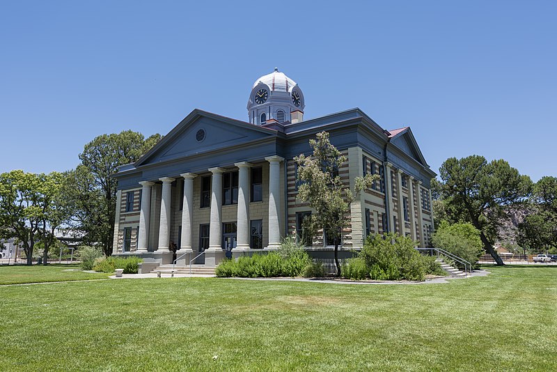
File:Jeff_Davis_County_Courthouse_June_2020.jpg · Wikimedia Commons · See Wikimedia Commons
Jeff Davis County
Sign in to saveAlso known as Jeff Davis County, Texas, Jeff Davis County, TX
county in Texas, United States
Key facts
- Country
- United States
- State
- Texas
- Named after
- Jefferson Davis
- Seat
- Fort Davis
- Largest town
- Fort Davis
- Total
- 2,265 sq mi (5,870 km )
- Land
- 2,265 sq mi (5,870 km )
- Water
- 0.08 sq mi (0.21 km ) 0%
- Estimate 2025
- 1,711
- Density
- 0.8812/sq mi (0.3402/km )
- Time zone
- UTC−6 ( Central )
- Summer dst
- UTC−5 ( CDT )
- Congressional district
- 23rd
- Website
- www .jeffdaviscounty .texas .gov
via Wikipedia infobox
Wikidata facts
- Named after
- Jefferson Davis
- Country
- United States
- Located in
- Texas
- Capital
- Fort Davis
- Population
- 1996
- Area
- 5865
- Time zone
- Central Time Zone
- Shares border with
- Culberson County
- Official website
- www.jeffdaviscounty.texas.gov
- Image
- JeffDavisCountyCourthouse.jpg
- Households
- 991
Show 8 more facts
- topic's main category
- Category:Jeff Davis County, Texas
- topic has template
- Template:Jeff Davis County, Texas
- Commons category
- Jeff Davis County, Texas
- inception
- 1887-01-01
- different from
- Jefferson Davis Parish
- water as percent of area
- 0
- native label
- Jeff Davis County
- per capita income
- 23118
Sources (10)
via Wikidata · CC0
~15 min read
Encyclopedic overview
Jeff Davis County is a county in the U.S. state of Texas. As of the 2020 census, its population was 1,996. Its county seat is Fort Davis. The county is named for Jefferson Davis, who served as the 23rd United States Secretary of War in the 1850s, and as Confederate president.
Jeff Davis County is recognizable for its unique shape; it is a pentagon that has no north–south nor east–west boundaries, save for a six-mile line serving as its southern boundary. It is the only county in the United States that touches a foreign country (Mexico) at a single point. Jeff Davis is one of the nine counties that compose the Trans-Pecos region of West Texas.
Excerpted from Wikipedia’s “Jeff Davis County” article, available under the CC BY-SA 4.0 licence.
Gallery (6)
On the map
4 mapped locations