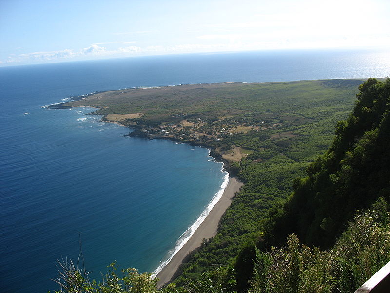
File:Kalaupapa_penninsula.jpg · Wikimedia Commons · See Wikimedia Commons
Kalawao County
Sign in to saveAlso known as Kalawao County, Hawaii, Kalawao County, HI
county in Hawaii, United States
Key facts
- Country
- United States
- State
- Hawaii
- Named after
- Kalawao
- Seat
- none (administered by Hawaii Dept. of Health )
- Largest community
- Kalaupapa
- Total
- 53 sq mi (140 km )
- Land
- 12 sq mi (31 km )
- Water
- 41 sq mi (110 km ) 77.3%
- Density
- 6.8/sq mi (2.6/km )
- Time zone
- UTC−10 ( Hawaii–Aleutian )
- Congressional district
- 2nd
via Wikipedia infobox
Wikidata facts
- Named after
- Kalawao
- Country
- United States
- Located in
- Hawaii
- Population
- 82
- Area
- 136
- Body of water
- Pacific Ocean
- Shares border with
- Maui County
- Image
- Kalaupapa penninsula.jpg
- Households
- 306
Show 8 more facts
- Commons category
- Kalawao County, Hawaii
- topic's main category
- Category:Kalawao County, Hawaii
- inception
- 1905-00-00
- coextensive with
- Kalaupapa Leprosy Settlement and National Historical Park
- water as percent of area
- 77.3
- native label
- Kalawao County
- located in/on physical feature
- Molokaʻi
- per capita income
- 48687
Sources (8)
via Wikidata · CC0
~8 min read
Encyclopedic overview
(Learn how and when to remove this message)
Kalawao County (Hawaiian: Kalana o Kalawao) is a county in the U.S. state of Hawaii. It is the smallest county in the 50 states by land area and the second-smallest county by population, after Loving County, Texas. The county encompasses the peninsula on the north coast of the island of Molokaʻi. The peninsula was developed and used from 1866 to 1969 as a leper colony, chosen because it is isolated from the rest of Molokaʻi by cliffs over a quarter-mile high; the only land access is a mule trail, now closed to visitors.
Excerpted from Wikipedia’s “Kalawao County” article, available under the CC BY-SA 4.0 licence.