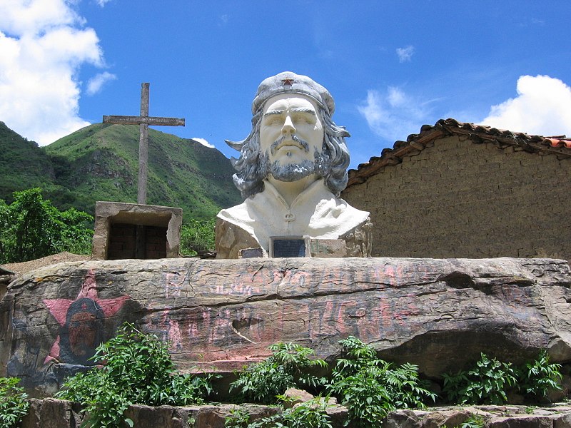
File:Che_Guevara_statue.jpg · Wikimedia Commons · See Wikimedia Commons
La Higuera
Sign in to saveAlso known as La Higuera, Vallegrande, La Higuera, Bolivia
village in Bolivia
OverviewAI-generated
La Higuera is a city located in Vallegrande Province within the Santa Cruz Department of Bolivia. It is situated in the Municipio Pucará and has an elevation of 2160 meters above sea level. The settlement is classified as a residential area.
According to available data, the population of La Higuera is listed as 119. Current weather observations indicate a temperature of 8.23, humidity of 85, pressure of 1015, and wind speed of 1.02.
Synthesized by Vinony from 25 facts across 6 sources: Wikidata, Openweathermap, OpenStreetMap, GeoNames, Vinony graph, Geo. Generated from structured data (not the Wikipedia text) and checked against those facts — may still contain errors.
Weather now
7-day forecast
via Open-Meteo
Key facts
- Country
- Bolivia
- Department
- Santa Cruz
- Province
- Vallegrande
- Municipality
- Pucará
- Canton
- La Higuera
- Time zone
- UTC-4 (BOT)
via Wikipedia infobox
Wikidata facts
- Instance of
- city
- Country
- Bolivia
- Located in
- Vallegrande Province (Santa Cruz)
- Population
- 119
- Elevation
- 2160
- Image
- Che Guevara statue.jpg
Show 2 more facts
- Commons category
- La Higuera (Bolivia)
- P12749
- Mackenzie River
Sources (2)
via Wikidata · CC0
~2 min read
Encyclopedic overview
La Higuera (Spanish for 'The Fig Tree'; pronounced [lajˈɣeɾa]) is a small village in Bolivia located in the Province of Vallegrande, in the Department of Santa Cruz. It is situated in the La Higuera Canton (civil parish) belonging to the Pucará Municipality.
Geography
Excerpted from Wikipedia’s “La Higuera” article, available under the CC BY-SA 4.0 licence.