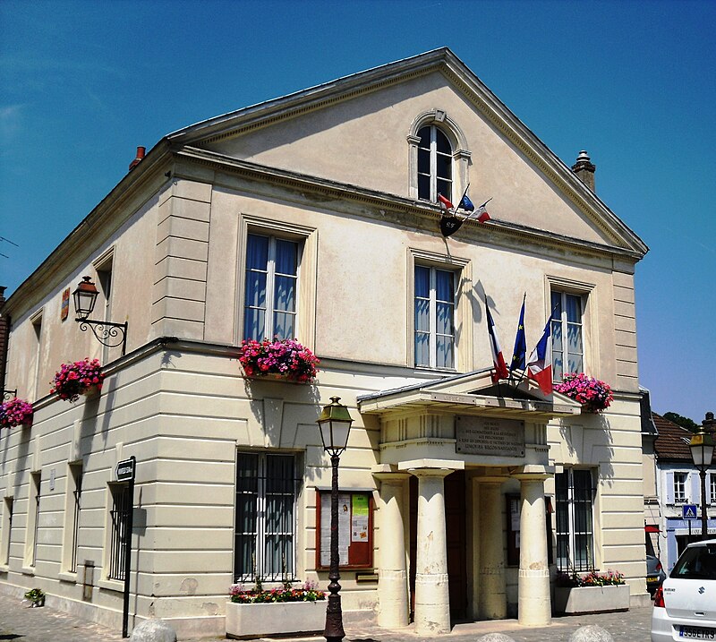
File:LimoursMairie.JPG · Wikimedia Commons · See Wikimedia Commons
Limours
Sign in to savecommune française du département de l'Essonne
OverviewAI-generated
Limours is a commune in France, situated in the Île-de-France region. It serves as the capital of the canton of Limours and is associated with the canton of Dourdan. The municipality is located within the arrondissement of Palaiseau and has historically been part of the Seine-et-Oise and Essonne administrative entities. Limours borders the communes of Les Molières, Forges-les-Bains, Bonnelles, and Briis-sous-Forges.
The area of the commune is 14.25 square kilometers, with an elevation of 177 meters above sea level. Its population is recorded as 6,843, comprising 3,201 males and 3,424 females. Limours maintains twinning relationships with Nioro du Sahel and Minfeld. The town is a member of the Concours des villes et villages fleuris.
Synthesized by Vinony from 39 facts across 6 sources: Wikidata, Openweathermap, OpenStreetMap, GeoNames, Vinony graph, Geo. Generated from structured data (not the Wikipedia text) and checked against those facts — may still contain errors.
Weather now
Place details
- Locality
- Limours
- Region
- Île-de-France
- Country
- France
- Population
- 6,414
- Timezone
- Europe/Paris
via OpenStreetMap · GeoNames
Key facts
- French commune.name
- Limours
- French commune.commune status
- Commune
- French commune.image
- LimoursMairie.JPG
- French commune.caption
- The town hall in Limours
- French commune.image coat of arms
- Blason ville fr Limours (Essonne).svg
- French commune.INSEE
- 91338
- French commune.postal code
- 91470
- French commune.arrondissement
- Palaiseau
- French commune.canton
- Dourdan
- French commune.intercommunality
- Pays de Limours
- French commune.mayor
- Chantal Thiriet
- French commune.term
- 2020–2026
- French commune.elevation min m
- 100
- French commune.elevation max m
- 177
- French commune.area km2
- 14.25
via Wikipedia infobox
Wikidata facts
- Instance of
- commune of France
- Official name
- Limours
- Country
- France
- Located in
- arrondissement of Palaiseau
- Population
- 6408
- Area
- 14.25
- Elevation
- 164
- Time zone
- UTC+02:00
- Capital of
- canton of Limours
- Shares border with
- Pecqueuse
- Official website
- www.mairie-limours.fr
- Image
- LimoursMairie.JPG
Show 9 more facts
- Commons category
- Limours
- postal code
- 91470
- associated electoral district
- canton of Dourdan
- male population
- 3201
- female population
- 3424
- twinned administrative body
- Minfeld
- email address
- mailto:[email protected]
- phone number
- +33-1-64-91-63-63
Sources (10)
via Wikidata · CC0
Article · Français
Limours (prononcé [limuʁ] ), parfois appelée Limours-en-Hurepoix, est une commune française située à trente et un kilomètres au sud-ouest de Paris dans le département de l’Essonne en région Île-de-France. Situé sur un plateau traversé par un ruisseau, la Prédecelle, le bourg agricole et commerçant rival d’Arpajon fut intégré au domaine royal en 1376 par Charles V, puis donné en apanage aux mignons et favoris. Limours fut dans les années 1930 directement reliée à Paris par la ligne Paris - Chartres par Gallardon jusqu’à sa fermeture à la veille de la Seconde Guerre mondiale. Dès lors restée relativement à l’écart des axes majeurs de communication, elle conserve son aspect rural, avec près de 55 % du territoire consacré à la grande culture céréalière et plus de 20 % occupés par des bois communaux, un centre-ville commerçant, privilégiée pour l’accueil des équipements structurants par son ancien statut de chef-lieu de canton et de principal centre urbain de l’intercommunalité. Ses habitants sont appelés les Limouriens.
Abstract from DBpedia / Wikipedia · CC BY-SA
Gallery (2)
On the map
3 mapped locations