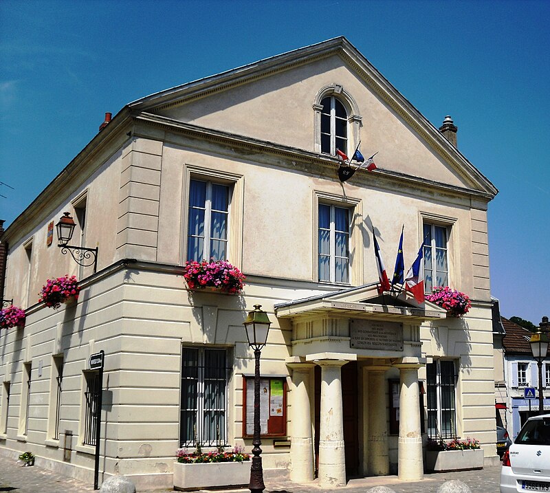
File:LimoursMairie.JPG · Wikimedia Commons · See Wikimedia Commons
OverviewAI-generated
Limours is a commune in France, situated in the Île-de-France region. It serves as the capital of the canton of Limours and is associated with the canton of Dourdan. The municipality is located within the arrondissement of Palaiseau and has historically been part of the Seine-et-Oise and Essonne administrative entities. Limours borders the communes of Les Molières, Forges-les-Bains, Bonnelles, and Briis-sous-Forges.
The area of the commune is 14.25 square kilometers, with an elevation of 177 meters above sea level. Its population is recorded as 6,843, comprising 3,201 males and 3,424 females. Limours maintains twinning relationships with Nioro du Sahel and Minfeld. The town is a member of the Concours des villes et villages fleuris.
Synthesized by Vinony from 39 facts across 6 sources: Wikidata, Openweathermap, OpenStreetMap, GeoNames, Vinony graph, Geo. Generated from structured data (not the Wikipedia text) and checked against those facts — may still contain errors.
Weather now
Place details
- Locality
- Limours
- Region
- Île-de-France
- Country
- France
- Population
- 6,414
- Timezone
- Europe/Paris
via OpenStreetMap · GeoNames
Key facts
- French commune.name
- Limours
- French commune.commune status
- Commune
- French commune.image
- LimoursMairie.JPG
- French commune.caption
- The town hall in Limours
- French commune.image coat of arms
- Blason ville fr Limours (Essonne).svg
- French commune.INSEE
- 91338
- French commune.postal code
- 91470
- French commune.arrondissement
- Palaiseau
- French commune.canton
- Dourdan
- French commune.intercommunality
- Pays de Limours
- French commune.mayor
- Chantal Thiriet
- French commune.term
- 2020–2026
- French commune.elevation min m
- 100
- French commune.elevation max m
- 177
- French commune.area km2
- 14.25
via Wikipedia infobox
Wikidata facts
- Instance of
- commune of France
- Official name
- Limours
- Country
- France
- Located in
- arrondissement of Palaiseau
- Population
- 6408
- Area
- 14.25
- Elevation
- 164
- Time zone
- UTC+02:00
- Capital of
- canton of Limours
- Shares border with
- Pecqueuse
- Official website
- www.mairie-limours.fr
- Image
- LimoursMairie.JPG
Show 9 more facts
- Commons category
- Limours
- postal code
- 91470
- associated electoral district
- canton of Dourdan
- male population
- 3201
- female population
- 3424
- twinned administrative body
- Minfeld
- email address
- mailto:[email protected]
- phone number
- +33-1-64-91-63-63
Sources (10)
via Wikidata · CC0
Article · Português
Limours, às vezes chamada Limours-en-, é uma comuna francesa, localizada a trinta quilômetros a sudoeste de Paris, no departamento de Essonne na região da Ilha de França. É a sede do decanato de Limours. Localizada em um planalto atravessado por um córrego, o , o burgo agrícola e comercial rival de Arpajon, integrado ao domínio real em 1376 por Carlos V, depois dado em apanágio aos mignons e favoritos. Limours foi na década de 1930 diretamente ligada a Paris pela , até o seu encerramento na véspera da Segunda Guerra Mundial. Portanto manteve-se relativamente em diferença dos grandes eixos de comunicação, ela conserva seu aspecto rural, com cerca de 55% do território consagrado à grande cultura de cereais e mais de 20 % ocupados por bosques comunais, um centro da cidade comercial, privilegiada pela recepção de equipamentos estruturantes pelo seu antigo status de sede de cantão e principal centro urbano de intercomunalidade. Seus habitantes são chamados de Limouriens.
Abstract from DBpedia / Wikipedia · CC BY-SA
Gallery (2)
On the map
3 mapped locations