File:Mairie_de_Loyettes.JPG · Wikimedia Commons · See Wikimedia Commons
Loyettes
Sign in to saveLoyette () is a commune in the Ain department in eastern France.
OverviewAI-generated
Loyettes is a commune in France, situated within the Ain department and the arrondissement of Belley. It lies in the Auvergne-Rhône-Alpes region and is part of the canton of Lagnieu. The municipality shares borders with Saint-Jean-de-Niost, Saint-Maurice-de-Gourdans, Saint-Vulbas, and Anthon. Its official postal code is 01360.
The area of Loyettes is 21.28 square kilometers, with an elevation above sea level recorded at 204 meters. The population is 3,554, comprising 1,544 males and 1,602 females. The commune is located next to the Rhône and Ain bodies of water.
Synthesized by Vinony from 53 facts across 8 sources: Wikidata, Open Meteo, Openweathermap, OpenStreetMap, GeoNames, Firecrawl, Vinony graph, Geo. Generated from structured data (not the Wikipedia text) and checked against those facts — may still contain errors.
Weather now
cached 19h ago7-day forecast
via Open-Meteo
Place details
- Locality
- Loyettes
- Region
- Auvergne-Rhône-Alpes
- Country
- France
- Population
- 2,541
- Timezone
- Europe/Paris
via OpenStreetMap · GeoNames
Key facts
- French commune.name
- Loyettes
- French commune.commune status
- Commune
- French commune.image
- Mairie de Loyettes.JPG
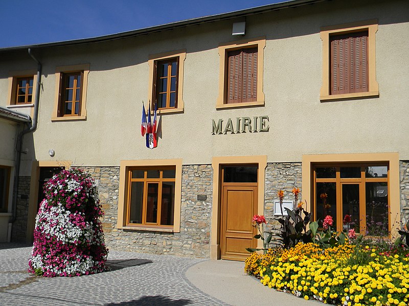
- French commune.caption
- Town hall
- French commune.image coat of arms
- Blason ville fr Loyettes (Ain) (potencée).svg
- French commune.arrondissement
- Belley
- French commune.canton
- Lagnieu
- French commune.INSEE
- 01224
- French commune.postal code
- 01360
- French commune.mayor
- Jean-Pierre Gagne
- French commune.term
- 2020–2026
- French commune.intercommunality
- Plaine de l'Ain
- French commune.elevation m
- 192
- French commune.elevation min m
- 185
- French commune.elevation max m
- 204
- French commune.area km2
- 21.28
via Wikipedia infobox
Official website
Mairie de Loyettes -
commune-loyettes.fr →Link to the official site · 19,212 chars · not written by Vinony
Wikidata facts
- Instance of
- commune of France
- Official name
- Loyettes
- Country
- France
- Located in
- arrondissement of Belley
- Population
- 3554
- Area
- 21.28
- Elevation
- 193
- Body of water
- Ain
- Shares border with
- Saint-Romain-de-Jalionas
- Official website
- www.commune-loyettes.fr
- Image
- Mairie de Loyettes.JPG
Show 8 more facts
- Commons category
- Loyettes
- postal code
- 01360
- associated electoral district
- canton of Lagnieu
- male population
- 1544
- female population
- 1602
- P8168
- MTA
- email address
- mailto:[email protected]
- phone number
- +33-4-78-32-70-28
via Wikidata · CC0
~1 min read
Encyclopedic overview
5 sectionsContents
- Geography
- Climate
- Population
- See also
- References
Loyette () is a commune in the Ain department in eastern France.
==Geography== ===Climate=== Loyettes has an oceanic climate (Köppen climate classification Cfb). The average annual temperature in Loyettes is . The average annual rainfall is with October as the wettest month. The temperatures are highest on average in July, at around , and lowest in January, at around . The highest temperature ever recorded in Loyettes was on 13 August 2003; the coldest temperature ever recorded was on 20 December 2009.
Excerpted from Wikipedia’s “Loyettes” article, available under the CC BY-SA 4.0 licence.
Gallery (2)
On the map
2 mapped locations