File:Macapá_Montage_(2021).jpg · Wikimedia Commons · See Wikimedia Commons
Macapá
Sign in to saveAlso known as Macapa, MCP, São José de Macapá, Sam Joze de Macapá
Gemeinde im Bundesstaat Amapá, Brasilien
Macapá is the capital of Amapá state in northern Brazil, located near the mouth of the Amazon River where it meets the Atlantic Ocean, with a population of over 512,000 people. The city is notable for sitting directly on the equator and being relatively isolated, accessible mainly by ferry or through the neighboring French territory of French Guiana.
AI-generated from the Wikipedia summary — may contain errors.
Key facts
- Settlement.image_caption
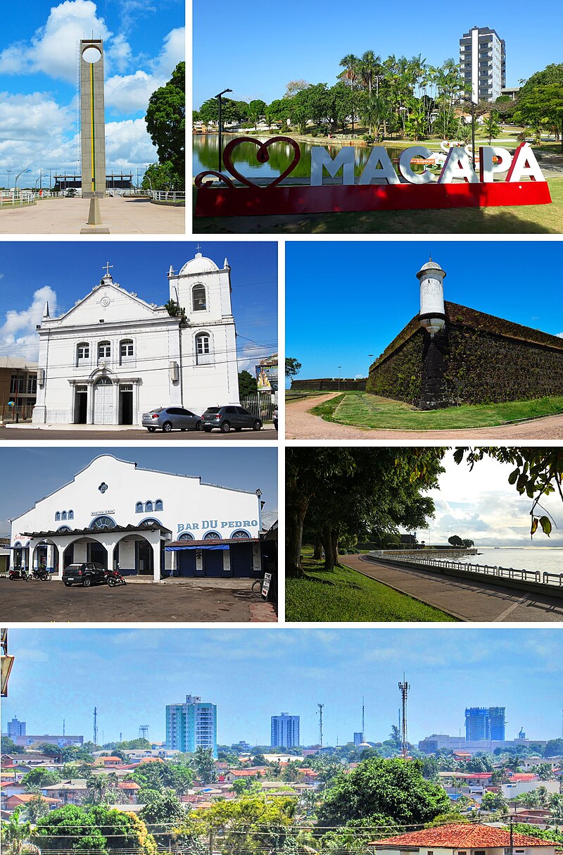
- From the top, clockwise: Marco Zero of Ecuador; Floriano Peixoto Square; Main Church of São José de Macapá; Fortress of São José de Macapá; Trapiche Eliezer Levy and Central Market; Rim of Macapá; city center view.
- Settlement.image_flag
- Bandeira de Macapá.svg
- Settlement.image_seal
- Brasão de Macapá.svg
- Settlement.image_map
- Brazil Amapa Macapa location map.svg
- Settlement.mapsize
- 250px
- Settlement.map_caption
- Location of Macapá in the State of Amapá
- Settlement.pushpin_map
- Brazil
- Settlement.pushpin_map_caption
- Location in Brazil
- Settlement.pushpin_relief
- yes
- Settlement.subdivision_type
- Country
- Settlement.subdivision_type1
- Region
- Settlement.subdivision_type2
- State
- Settlement.subdivision_name1
- North
- Settlement.leader_title
- Mayor
- Settlement.leader_name
- Antônio Furlan (Cidadania)
- Settlement.established_title
- Founded
- Settlement.established_date
- February 4, 1758
- Settlement.area_total_km2
- 6407.12
via Wikipedia infobox
Wikidata facts
- Instance of
- human settlement
- Official name
- São José de Macapá
- Demonym
- macapaense
- Country
- Brazil
- Located in
- Amapá
- Population
- 282745
- Area
- 6408.545
- Elevation
- 19
- Time zone
- UTC−03:00
- Body of water
- Atlantic Ocean
- Capital of
- Amapá
- Shares border with
- Porto Grande
- Official website
- www.prefeiturademacapa.ap.gov.br
- Image
- Macapá Montage (2021) 2.jpg
- Dialing code
- 96
Show 9 more facts
- Commons category
- Macapá
- topic's main category
- Category:Macapá
- inception
- 1758-02-04
- postal code
- 68906-000
- Human Development Index
- 0.733
- category of associated people
- Category:People from Macapá
- twinned administrative body
- Kourou
- electorate
- 299068
- native label
- Macapá
Sources (8)
via Wikidata · CC0
Article · Deutsch
Macapá, amtlich Município de Macapá, ist die Hauptstadt des brasilianischen Bundesstaates Amapá. Sie liegt im Norden des Landes direkt am Äquator und der Mündung des Amazonas, nördlich der Insel Marajó. Macapá hatte 344.153 Einwohner (Stand 2010, Volkszählung des IBGE) auf einer Fläche von etwa 6564 Quadratkilometern (Stand 2019). Die Bevölkerungsdichte beträgt damit 61 Einwohner pro Quadratkilometer. Die Bevölkerungszahl wurde vom IBGE zum 1. Juli 2020 auf 512.902 Einwohner geschätzt, die Macapaenser genannt werden. Die Großstadt ist Zentrum der .
Abstract from DBpedia / Wikipedia · CC BY-SA
Gallery (21)
On the map
3 mapped locations
Available in 69 languages
- Español
- Français
- Deutsch
- 中文
- 日本語
- Русский
- Português
- Italiano
- العربية
- हिन्दी
- Aragonese
- Armenian
- Bahasa Indonesia
- Basque
- Belarusian
- Bishnupriya
- Bulgarian
- Catalan
Show 50 more
- Cebuano
- Croatian
- Czech
- Danish
- Esperanto
- Estonian
- Finnish
- Galician
- Georgian
- Greek
- Hebrew
- Hungarian
- Ido
- Interlingua
- Irish
- Kazakh
- Latvian
- Lithuanian
- Malagasy
- Marathi
- Mazanderani
- Mirandese
- Nederlands
- Northern Frisian
- Norwegian
- Norwegian Nynorsk
- Occitan
- Ossetic
- Polski
- Romanian
- Serbian
- Serbian (Latin)
- simple
- Svenska
- Swahili
- Tajik
- Tatar
- Tetum
- Tiếng Việt
- Türkçe
- Ukrainian
- Urdu
- Volapük
- Waray
- Western Panjabi
- Wu Chinese
- zh_min_nan
- فارسی
- ไทย
- 한국어
via Wikidata sitelinks · CC0