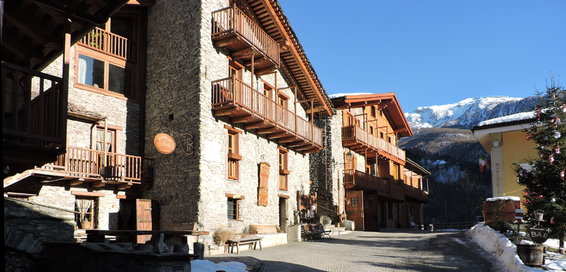
File:Marmora_pan.png · Wikimedia Commons · See Wikimedia Commons
Key facts
- Country
- Italy
- Region
- Piedmont
- Province
- Province of Cuneo (CN)
- Frazioni
- Tolosano, Torello, Garino, Urzio, Arvaglia, Arata, Reinero, Finello, S. Sebastiano, Vernetti
- Total
- 41.2 km (15.9 sq mi)
- Elevation
- 1,223 m (4,012 ft)
- Density
- 2.4/km (6.1/sq mi)
- Time zone
- UTC+1 ( CET )
- Summer dst
- UTC+2 ( CEST )
- Dialing code
- 0171
via Wikipedia infobox
Wikidata facts
- Instance of
- comune of Italy
- Official name
- Marmora
- Country
- Italy
- Located in
- Province of Cuneo
- Population
- 54
- Area
- 41.13
- Elevation
- 1225
- Time zone
- UTC+02:00
- Shares border with
- Stroppo
- Official website
- www.comune.marmora.cn.it
- Image
- Marmora pan.png
- Dialing code
- 0171
- Licence plate code
- CN
- Patron saint
- Maximus of Turin
Show 2 more facts
- postal code
- 12020
- Commons category
- Marmora
Sources (6)
via Wikidata · CC0
~1 min read
Encyclopedic overview
Marmora is a comune (municipality) in the Province of Cuneo in the Italian region Piedmont, located about 80 kilometres (50 mi) southwest of Turin and about 35 kilometres (22 mi) west of Cuneo. As of 31 December 2004, it had a population of 97 and an area of 41.2 square kilometres (15.9 mi).
The municipality of Marmora contains the frazioni (subdivisions, mainly villages and hamlets) Tolosano, Torello, Garino, Urzio, Arvaglia, Arata, Reinero, Finello, S. Sebastiano, and Vernetti.
Excerpted from Wikipedia’s “Marmora” article, available under the CC BY-SA 4.0 licence.