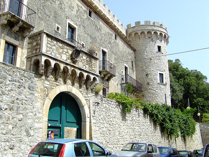
File:Castello_1.JPG · Wikimedia Commons · See Wikimedia Commons
Monteroduni
Sign in to saveMonteroduni is a comune (municipality) in the Province of Isernia in the Italian region Molise, located about west of Campobasso and about southwest of Isernia.
In the Vinony graph
Within Vinony's link graph, Monteroduni is referenced by 67 other articles, and connects out to Italy, time zone and Molise.
The entry is geolocated on the map in city(2,412)_region, across 2 mapped points.
It sits within the topics Cities and towns in Molise and Municipalities of the Province of Isernia.
Its subject is documented across 49 Wikipedia language editions.
Key facts
- Italian comune.name
- Monteroduni
- Italian comune.official_name
- Comune di Monteroduni
- Italian comune.image_skyline
- Castello 1.JPG
- Italian comune.image_caption
- Castello Pignatelli
- Italian comune.image_shield
- Monteroduni-Stemma.gif
- Italian comune.region
- Molise
- Italian comune.province
- Isernia (IS)
- Italian comune.frazioni
- Campo Fiorito, Campo la Fontana, Carpinete, Guado Largo, Limate, Pagliara, San Nazzaro, Sant'Eusanio, Selvotta, Socce, Starze
- Italian comune.mayor
- Nicola Altobelli
- Italian comune.area_total_km2
- 37.22
- Italian comune.population_total
- 2054
- Italian comune.population_as_of
- 31 August 2022
- Italian comune.population_demonym
- Monterodunesi
- Italian comune.elevation_m
- 476
- Italian comune.saint
- St. Michael Archangel
- Italian comune.day
- 29 September
- Italian comune.postal_code
- 86075
- Italian comune.area_code
- 0865
via Wikipedia infobox
Wikidata facts
- Instance of
- comune of Italy
- Official name
- Monteroduni
- Demonym
- monterodunesi
- Country
- Italy
- Located in
- province of Isernia
- Population
- 2065
- Area
- 37.22
- Elevation
- 459
- Time zone
- UTC+02:00
- Shares border with
- Sant'Agapito
- Official website
- www.comune.monteroduni.is.it
- Image
- Monteroduni 2012 by-RaBoe 17.jpg
- Dialing code
- 0865
- Licence plate code
- IS
- Patron saint
- Archangel Michael
Show 2 more facts
- Commons category
- Monteroduni
- postal code
- 86075
Sources (8)
via Wikidata · CC0
~1 min read
Encyclopedic overview
3 sectionsContents
- See also
- References
- External links
Monteroduni is a comune (municipality) in the Province of Isernia in the Italian region Molise, located about west of Campobasso and about southwest of Isernia.
The town's name derives from the ancient one of the river Volturno, Olotrunus. Sights include the Pignatelli Castle, built by the Lombards in the 9th century and later enlarged under the D'Evoli family.
Excerpted from Wikipedia’s “Monteroduni” article, available under the CC BY-SA 4.0 licence.
Gallery (2)
On the map
2 mapped locations