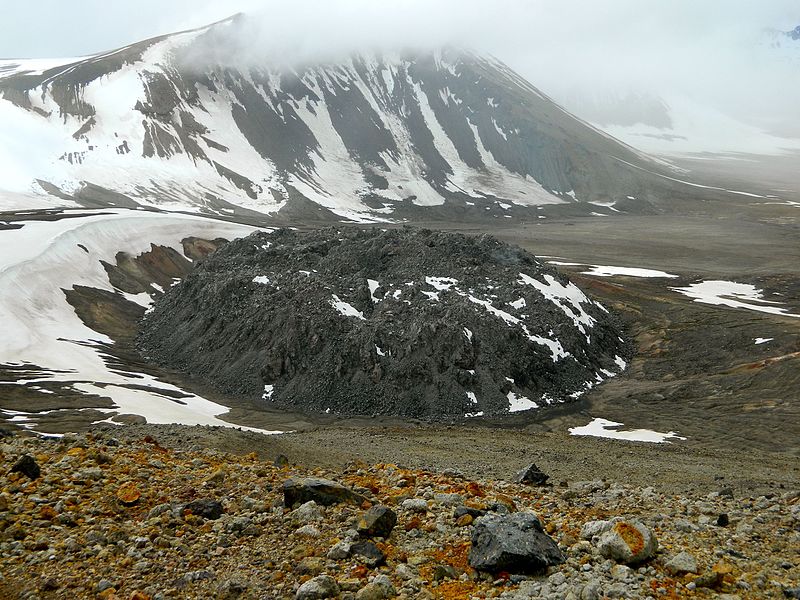
File:Novarupta_(13543091424).jpg · Wikimedia Commons · See Wikimedia Commons
Novarupta
Sign in to saveNovarupta is a volcano located on the Alaska Peninsula on a slope of Trident Volcano in Katmai National Park and Preserve, about southwest of Anchorage. Novarupta was formed in 1912, during the largest volcanic eruption of the 20th century, in which it released 30 times the volume of magma of the 1980 eruption of Mount St. Helens.
Key facts
- Mountain.name
- Novarupta
- Mountain.photo
- Novarupta (13543091424).jpg
- Mountain.photo_caption
- Novarupta's lava dome in June 2011
- Mountain.elevation_ft
- 2759
- Mountain.range
- Aleutian Range
- Mountain.listing
- Volcanoes in the United States
- Mountain.country
- United States
- Mountain.state
- Alaska
- Mountain.part_type
- Protected area
- Mountain.part
- Katmai National Park and Preserve
- Mountain.map_image
- Map of Alaska Peninsula Volcanoes.gif
- Mountain.map_caption
- Map showing volcanoes of the Alaska Peninsula, with Novarupta towards the northeast
- Mountain.topo
- USGS Mount Katmai B-4
- Mountain.formed_by
- Subduction zone volcanism
- Mountain.type
- Caldera with lava dome
- Mountain.volcanic_arc
- Aleutian Arc
- Mountain.last_eruption
- June to October 1912
- Mountain.fetchwikidata
- ALL
via Wikipedia infobox
Wikidata facts
- Instance of
- volcano
- Part of
- Aleutian Islands
- Country
- United States
- Located in
- Alaska
- Elevation
- 841
- Image
- Novarupta.jpg
Show 5 more facts
- name in kana
- ノバラプタ
- Commons category
- Novarupta
- located in protected area
- Katmai National Park and Preserve
- volcano observatory
- Alaska Volcano Observatory
- mountain range
- Aleutian Range
Sources (1)
via Wikidata · CC0
~4 min read
Encyclopedic overview
7 sectionsContents
- Eruption of 1912
- Valley of Ten Thousand Smokes
- Katmai National Park
- See also
- Notes
- References
- External links
Novarupta is a volcano located on the Alaska Peninsula on a slope of Trident Volcano in Katmai National Park and Preserve, about southwest of Anchorage. Novarupta was formed in 1912, during the largest volcanic eruption of the 20th century, in which it released 30 times the volume of magma of the 1980 eruption of Mount St. Helens.
==Eruption of 1912==
Excerpted from Wikipedia’s “Novarupta” article, available under the CC BY-SA 4.0 licence.
Gallery (8)
On the map
5 mapped locations