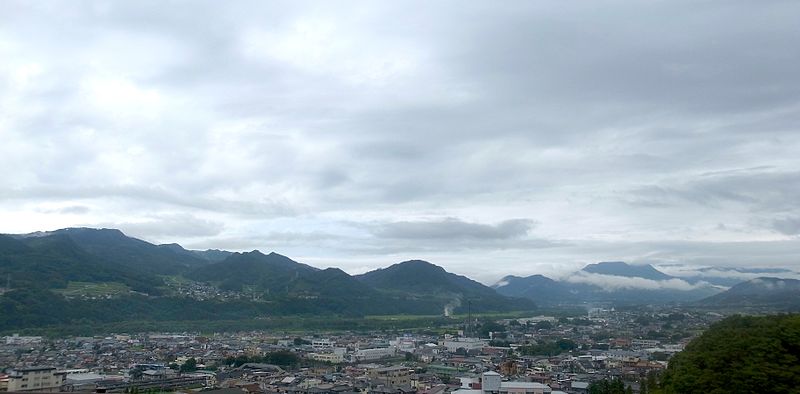
File:Numata-area-aug12-2014.jpg · Wikimedia Commons · See Wikimedia Commons
نوماتا، غونما
Sign in to savecity in Gunma prefecture, Japan
Key facts
- Country
- Japan
- Region
- Kantō
- Prefecture
- Gunma
- Town settled
- April 1, 1889
- City settled
- April 1, 1954
- Mayor
- Minoru Hoshino (星野稔) - from May 2022
- Total
- 443.46 km (171.22 sq mi)
- Density
- 105.78/km (273.96/sq mi)
- Time zone
- UTC+9 ( Japan Standard Time )
- Phone number
- 0278-23-2111
- Address
- Shimono-machi 999, Numata-shi, Gunma-ken 378-8501
- Climate
- Cfa
- Website
- Official website
- Flower
- Chinese bellflower
- Tree
- Sakura
via Wikipedia infobox
Wikidata facts
- Instance of
- city of Japan
- Country
- Japan
- Located in
- Gunma Prefecture
- Population
- 51265
- Area
- 443.46
- Time zone
- Japan Standard Time
- Shares border with
- Nikkō-shi
- Official website
- www.city.numata.gunma.jp
- Image
- Terrace Numata.jpg
Show 7 more facts
- Commons category
- Numata, Gunma
- topic's main category
- Category:Numata, Gunma
- name in kana
- ぬまたし
- inception
- 1954-04-01
- twinned administrative body
- Füssen
- associated electoral district
- Gunma 1st district
- native label
- 沼田市
Sources (10)
via Wikidata · CC0
Article · العربية
مدينة نوماتا (بالإنجليزية: Numata) هي أحد المدن التابعة لمحافظة غونما. تأسست رسميًا في 01/04/1954. ويقدر عدد سكانها بـ 52319 نسمة حسب تقدير مكتب الإحصاء الياباني لعام 2012. تبلغ مساحة نوماتا 443.37 كم2. بكثافة سكانية تبلغ 118 نسمة/كم2.
Abstract from DBpedia / Wikipedia · CC BY-SA