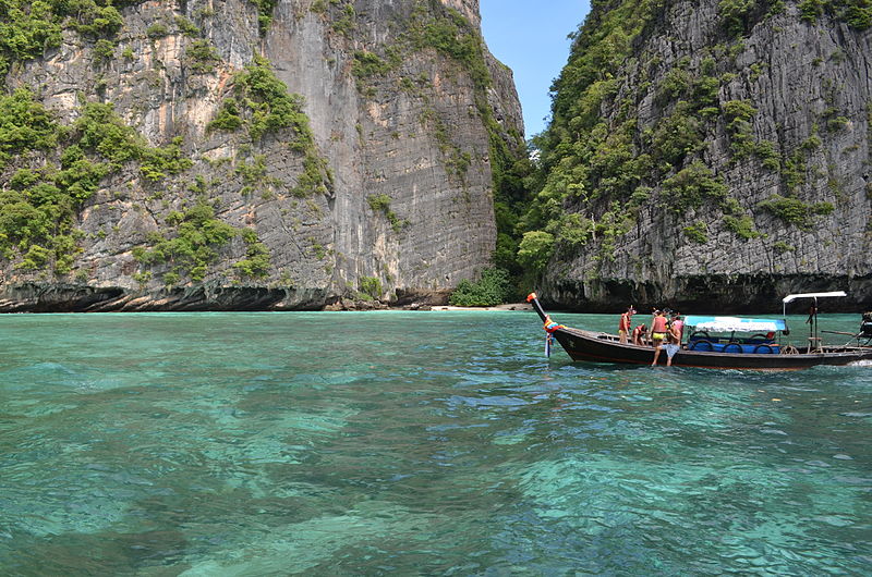
File:KohPhiPhi.JPG · Wikimedia Commons · See Wikimedia Commons
In the Vinony graph
Within Vinony's link graph, Phi Phi Islands is referenced by 60 other articles, and connects out to Phuket, Krabi and long-tail boat.
The entry is geolocated on the map.
It is catalogued under topics including Archipelagoes of Thailand, Car-free islands of Asia and Geography of Krabi province.
Its subject is documented across 33 Wikipedia language editions.
Key facts
- Location
- Strait of Malacca
- Archipelago
- Phi Phi Islands
- Major islands
- Ko Phi Phi Don and Ko Phi Phi Le
- Area
- 12.06 km (4.66 sq mi)
- Province
- Krabi
- District
- Mueang Krabi
- Tambon
- Ao Nang
- Largest village
- Ban Ko Phi Phi
- Population
- 2,500 (2018)
- Languages
- Thai , Southern Thai , Urak Lawoi
- Ethnic groups
- Urak Lawoi
- Time zone
- ICT ( UTC+7 )
via Wikipedia infobox
Wikidata facts
- Instance of
- archipelago
- Has part
- Ko Phi Phi Don
- Country
- Thailand
- Located in
- Ao Nang
- Area
- 12.25
- Elevation
- 1
- Time zone
- UTC+07:00
- Body of water
- Andaman Sea
- Image
- KohPhiPhi.JPG
Show 2 more facts
- native label
- หมู่เกาะพีพี
- Commons category
- Ko Phi Phi
Sources (3)
via Wikidata · CC0
~11 min read
Encyclopedic overview
The Phi Phi Islands (Thai: หมู่เกาะพีพี, RTGS: Mu Ko Phiphi, pronounced [mùː kɔ̀ʔ pʰīː.pʰīː]) are an island group in Thailand located in the Strait of Malacca between the large island of Phuket and the Straitscoast in the Krabi Province The islands are administratively part of Krabi Province. Ko Phi Phi Don (Thai: เกาะพีพีดอน, RTGS: Ko Phiphi Don) (ko Thai: เกาะ 'island') is the largest and most populated island of the group, although the beaches of the second largest island, Ko Phi Phi Le (Thai: เกาะพีพีเล, RTGS: Ko Phiphi Le) are visited by many people as well. The rest of the islands in the group, including Bida Nok, Bida Nai, and Ko Mai Phai, are not much more than large limestone rocks jutting out of the sea. The islands are reachable by ferries, speedboats or long-tail boats, most often from Krabi town or from ports in Phuket Province.
Phi Phi Don was initially populated by Thai Malay fishermen during the late-1940s, and later became a coconut plantation. The resident Thai population of Phi Phi Don remains more than 80 percent Muslim. The current population however—if counting transient workers—is more Buddhist than Muslim. The resident population is between 2,000 and 3,000 people (2018).
Excerpted from Wikipedia’s “Phi Phi Islands” article, available under the CC BY-SA 4.0 licence.