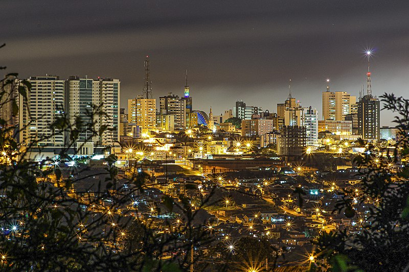
File:Ponta_Grossa_2019.jpg · Wikimedia Commons · See Wikimedia Commons
Ponta Grossa
Sign in to savemunicipality of Paraná state, Brazil
Key facts
- Country
- Brazil
- Region
- South
- State
- Paraná
- Settled town
- 15 September 1824
- Incorporated city
- 24 March 1862
- Type
- City hall
- Mayor
- Elizabeth Schmidt ( União Brasil )
- Council
- Ponta Grossa City Council
- Municipality
- 2,067.6 km (798.3 sq mi)
- Urban
- 172.41 km (66.57 sq mi)
- Elevation
- 975 m (3,199 ft)
- Estimate 2025
- 375,632
- Rank
- 76th, Brazil , 4th, Paraná
- Density
- 150.55/km (389.9/sq mi)
- Metro
- 430,075
- Demonym s
- pontagrossense , princesino
- Year
- 2015 estimate
- Total
- R$11,805,538.69 thousands ( 7th , Paraná)
via Wikipedia infobox
Wikidata facts
- Instance of
- big city
- Demonym
- ponta-grossense
- Country
- Brazil
- Located in
- Paraná
- Population
- 233984
- Area
- 2054.73
- Elevation
- 975
- Shares border with
- Carambeí
- Official website
- www.pontagrossa.pr.gov.br
- Image
- Ponta Grossa, Brazil.jpg
- Dialing code
- 42
Show 7 more facts
- twinned administrative body
- Kitwe
- Commons category
- Ponta Grossa
- topic's main category
- Category:Ponta Grossa
- Human Development Index
- 0.763
- inception
- 1823-09-15
- electorate
- 245588
- category of associated people
- Category:People from Ponta Grossa
Sources (6)
via Wikidata · CC0
~40 min read
Encyclopedic overview
Ponta Grossa ( Portuguese pronunciation: [ˈpõtɐ ˈɡɾɔsɐ] ) is a municipality in the state of Paraná, southern Brazil. The estimated population is 355,336 according to official data from the Brazilian Institute of Geography and Statistics and it is the 4th most populous city in Paraná (76th in Brazil). It is also the largest city close to Greater Curitiba region, so within a radius of 186 miles (300 km) of Ponta Grossa.
It is also known as Princesa dos Campos (in English: Princess of the Fields) and Capital Cívica do Paraná (in English: Civic Capital of Paraná). The city is connected to the Caminho das Tropas (in English: Path of the Troops), being one of the network of routes used by drovers (tropeiros) in the middle of a high hill inside a grassy vegetation. The city is considered of average size, located around a central hill, while most of its growth occurred in the second half of the twentieth century with the weakening of the primary economy.
Excerpted from Wikipedia’s “Ponta Grossa” article, available under the CC BY-SA 4.0 licence.
Gallery (12)
On the map
2 mapped locations