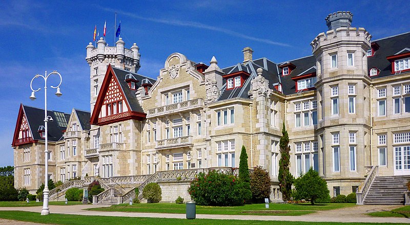
File:El_Palacio_de_la_Magdalena_(2).jpg · Wikimedia Commons · See Wikimedia Commons
Santander is a city in northern Spain and serves as the capital of the region of Cantabria. It is an important administrative and cultural center for the autonomous community.
AI-generated from the Wikipedia summary — may contain errors.
Wikidata facts
- Instance of
- municipality of Spain
- Official name
- Santander
- Demonym
- santanderines
- Country
- Spain
- Located in
- Cantabria
- Population
- 173635
- Area
- 36.08
- Elevation
- 15
- Time zone
- UTC+01:00
- Body of water
- Cantabrian Sea
- Capital of
- Comarca de Santander
- Shares border with
- Real Valle de Camargo
- Official website
- www.santander.es
- Image
- Muelle de Albareda, Santander.jpg
- Dialing code
- 942
- Licence plate code
- S
- Significant event
- 1941 Santander fire
Show 16 more facts
- described by source
- Encyclopædia Britannica 11th edition
- twinned administrative body
- Oviedo
- Commons category
- Santander
- postal code
- 39001–39012
- Commons gallery
- Santander
- topic's main category
- Category:Santander, Spain
- category of associated people
- Category:People from Santander, Spain
- category for people born here
- Category:Births in Santander, Spain
- category for people who died here
- Category:Deaths in Santander
- native label
- Santander
- inception
- 1755-01-09
- owner of
- Campos de Sport de El Sardinero
- male population
- 79555
- female population
- 92984
- different from
- Santander
- P12749
- Steve Mandanda
Sources (8)
via Wikidata · CC0
Article · Español
Santander es una ciudad situada en el norte de España, capital de la comunidad autónoma uniprovincial de Cantabria. Con 171 951 habitantes (2017), es el municipio más poblado de la comunidad autónoma. Es cabecera del área metropolitana de Santander, una conurbación de más de 300 000 habitantes que se extiende alrededor de la bahía de Santander. El término municipal limita al norte con el mar Cantábrico, al este con la bahía homónima, que lo rodea también por el sur junto al municipio de Camargo y al oeste limita con el municipio de Santa Cruz de Bezana. Su cota máxima, situada en Peñacastillo, se eleva 139 m sobre el nivel de mar.
Abstract from DBpedia / Wikipedia · CC BY-SA
Gallery (12)
On the map
2 mapped locations
Available in 99 languages
- Español
- Français
- Deutsch
- 中文
- 日本語
- Русский
- Português
- Italiano
- العربية
- Afrikaans
- Albanian
- Aragonese
- Armenian
- Asturian
- azb
- Azerbaijani
- Bahasa Indonesia
- Basque
Show 80 more
- be_x_old
- Belarusian
- Bosnian
- Breton
- Bulgarian
- Catalan
- Cebuano
- Chechen
- Cornish
- Croatian
- Czech
- dag
- Danish
- Egyptian Arabic
- Esperanto
- Estonian
- Extremaduran
- Finnish
- Galician
- Georgian
- Greek
- Hawaiian
- Hebrew
- Hungarian
- Icelandic
- Interlingua
- Interlingue
- Irish
- Javanese
- Kara-Kalpak
- Ladino
- Latin
- Latvian
- Lithuanian
- lld
- Lombard
- Low German
- Luxembourgish
- Malay
- Maltese
- Marathi
- Nederlands
- Northern Frisian
- Norwegian
- Norwegian Nynorsk
- Occitan
- Ossetic
- Piedmontese
- Polski
- Quechua
- Romanian
- Sardinian
- Scots
- Scottish Gaelic
- Serbian
- Serbian (Latin)
- Silesian
- simple
- Slovak
- Svenska
- Swahili
- Tajik
- Tamil
- Tatar
- Tetum
- Tiếng Việt
- Türkçe
- Ukrainian
- Urdu
- Venetian
- Waray
- Welsh
- Western Frisian
- Western Panjabi
- Wu Chinese
- zh_min_nan
- zh_yue
- فارسی
- ไทย
- 한국어
via Wikidata sitelinks · CC0