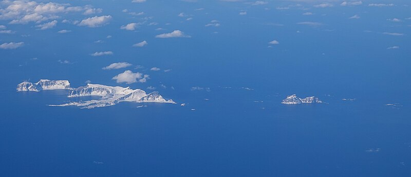
File:Vaeroey-Municipality.jpg · Wikimedia Commons · See Wikimedia Commons
Værøy Municipality
Sign in to savemunicipality in Nordland, Norway
Key facts
- Country
- Norway
- County
- Nordland
- District
- Lofoten
- Established
- 1 Jan 1838
- Administrative centre
- Sørland
- Mayor 2019
- Susann Hjørdis Berg Kristiansen ( LL )
- Total
- 18.64 km (7.20 sq mi)
- Land
- 18.61 km (7.19 sq mi)
- Water
- 0.03 km (0.012 sq mi) 0.2%
- Rank
- # 352 in Norway
- Highest elevation
- 450.13 m (1,476.8 ft)
- Density
- 36.6/km (95/sq mi)
- Change 10 years
- −12.1%
- Demonym
- Værøyværing
- Norwegian form
- Bokmål
- Time zone
- UTC+01:00 ( CET )
- Summer dst
- UTC+02:00 ( CEST )
- Iso 3166 code
- NO-1857
via Wikipedia infobox
Wikidata facts
- Instance of
- municipality of Norway
- Demonym
- værøyværing
- Country
- Norway
- Located in
- Nordland
- Capital
- Sørland
- Population
- 656
- Area
- 0
- Time zone
- UTC+01:00
- Shares border with
- Røst
- Official website
- varoy.kommune.no
- Image
- Sørland i Værøy kommune.jpg
- Households
- 12
Show 6 more facts
- Commons category
- Værøy
- topic's main category
- Category:Værøy Municipality
- located in/on physical feature
- Norwegian Sea
- Commons gallery
- Værøy
- inception
- 1838-01-01
- language used
- Bokmål
via Wikidata · CC0
~10 min read
Encyclopedic overview
Værøy is an island municipality in Nordland county, Norway. It is part of the traditional district of Lofoten. The administrative centre of the municipality is the village of Sørland on the main island of Værøya. The other village in Værøy is Nordland. Most of the residents live in the Sørland area surrounding the main harbor. The old Værøy Lighthouse sits at the end of that harbor.
The 19-square-kilometre (7.3 sq mi) municipality is the 352nd largest by area out of the 357 municipalities in Norway. Værøy Municipality is the 348th most populous municipality in Norway with a population of only 683. The municipality's population density is 36.6 inhabitants per square kilometre (95/sq mi) and its population has decreased by 12.1% over the previous 10-year period.
Excerpted from Wikipedia’s “Værøy Municipality” article, available under the CC BY-SA 4.0 licence.