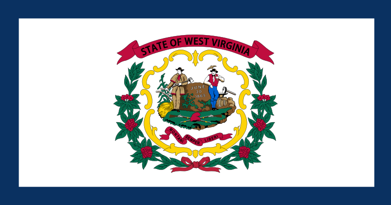
File:Flag_of_West_Virginia.svg · Wikimedia Commons · See Wikimedia Commons
West Virginia
Sign in to saveAlso known as The Mountain State, Almost Heaven, WV, West Virginia, United States, State of West Virginia, W. Va., W.Va., US-WV
state of the United States of America
West Virginia is a state located in the eastern United States, situated in the Appalachian region. It matters as one of the nation's states and contributes to the country's geography, economy, and political representation.
AI-generated from the Wikipedia summary — may contain errors.
Research
36,723 papers- Pain Management During West Virginia's Opioid Crisis.Journal of the American Board of Family Medicine : JABFM · 2022Haggerty T, Sedney CL, Dekeseredy P et al.DOI: 10.3122/jabfm.2022.05.220097
- West Virginia Perinatal Partnership.The West Virginia medical journal · 2015Loudin S, Maxwell S, Mitra S et al.
- The Opioid Epidemic in West Virginia.The health care manager · 2019Merino R, Bowden N, Katamneni S et al.DOI: 10.1097/HCM.0000000000000256
- Utilization of West Virginia Pediatric Medicaid Claims Data to Guide Outpatient Antimicrobial Stewardship Interventions.Journal of the Pediatric Infectious Diseases Society · 2022Kilgore JT, Lanata MM, Willis JM et al.DOI: 10.1093/jpids/piab125
- West Virginia lobotomy project.Journal of the American Medical Association · 1954FREEMAN W, DAVIS HW, EAST IC et al.DOI: 10.1001/jama.1954.02950100015007
- Alarmed by West Virginia's ordeal.Occupational health & safety (Waco, Tex.) · 2014Laws J
- Wild . . . But Not So Wonderful-Responding to Injection Drug Use in West Virginia.American journal of public health · 2019Pollini RADOI: 10.2105/AJPH.2018.304937
- The effect of ending public funding for abortion: evidence from West Virginia.Public health · 2024Kuroki MDOI: 10.1016/j.puhe.2024.06.014
via PubMed
Wikidata facts
- Instance of
- U.S. state
- Part of
- South Atlantic states
- Named after
- west
- Demonym
- Okcident-Virginiano
- Country
- United States
- Located in
- United States
- Contains
- Jefferson County
- Continent
- North America
- Capital
- Charleston
- Population
- 1793716
- Area
- 62755
- Elevation
- 455
- Time zone
- Eastern Time Zone
- Head of government
- Patrick Morrisey
- Legislature
- West Virginia Legislature
- Shares border with
- Kentucky
- Highest point
- Spruce Knob
- Official website
- www.wv.gov
- Households
- 734235
- Motto
- Montani semper liberi
Show 34 more facts
- topic's main Wikimedia portal
- Portal:West Virginia
- Commons category
- West Virginia
- topic's main category
- Category:West Virginia
- inception
- 1863-06-20
- category for people born here
- Category:Births in West Virginia
- category for people who died here
- Category:Deaths in West Virginia
- category for films shot at this location
- Category:Films shot in West Virginia
- category for people buried here
- Category:Burials in West Virginia
- category of associated people
- Category:People from West Virginia
- office held by head of government
- Governor of West Virginia
- Commons gallery
- West Virginia
- short name
- W.Va.
- nickname
- Mountain State
- lowest point
- Potomac River
- history of topic
- history of West Virginia
- water as percent of area
- 0.79
- native label
- State of West Virginia
- official symbol
- Northern Cardinal
- separated from
- Virginia
- maximum temperature record
- 112
- language used
- Pennsylvania German
- minimum temperature record
- -37
- has seal, badge, or sigil
- Seal of West Virginia
- marriageable age
- 18
- compulsory education (maximum age)
- 17
- OpenStreetMap zoom level
- 7
- topic has template
- Template:West Virginia
- official map URL
- mapwv.gov/gis.html
- related category
- Category:West Virginia-related lists
- per capita income
- 27346
- mean age
- 42.7
- hashtag
- WestVirginia
- minimum wage
- 8.75
- P8168
- Dysauxes ancilla
Sources (15)
via Wikidata · CC0
~40 min read
Encyclopedic overview
West Virginia is a mountainous, landlocked state in the Southern and Mid-Atlantic regions of the United States. It is bordered by Pennsylvania and Maryland to the northeast, Virginia to the southeast, Kentucky to the southwest, and Ohio to the northwest. West Virginia is the 10th-smallest state by area and ranks as the 12th-least populous state, with a population of 1,769,979 residents. The capital and most populous city is Charleston with a population of 49,055.
West Virginia was admitted into the Union on June 20, 1863, and was a key border state during the American Civil War. It separated from Virginia and was one of two states (along with Nevada) admitted to the Union during the Civil War. Some of its residents held slaves, but most were propertied farmers, and the delegates provided for the gradual abolition of slavery in the new state constitution. The state legislature abolished slavery in the state, and at the same time ratified the 13th Amendment abolishing slavery nationally on February 3, 1865.
Excerpted from Wikipedia’s “West Virginia” article, available under the CC BY-SA 4.0 licence.
Gallery (12)
On the map
Available in 191 languages
- Español
- Français
- Deutsch
- 中文
- 日本語
- Русский
- Português
- Italiano
- العربية
- हिन्दी
- Afrikaans
- Albanian
- Albanian
- Amharic
- Aragonese
- Armenian
- Arpitan
- Asturian
Show 172 more
- Aymara
- azb
- Azerbaijani
- Bahasa Indonesia
- Balinese
- Bangla
- Bashkir
- Basque
- bat_smg
- Bavarian
- be_x_old
- Belarusian
- Bhojpuri
- Bikol
- Bishnupriya
- Bislama
- Bosnian
- Breton
- Bulgarian
- Buriat
- Burmese
- Catalan
- cbk_zam
- cdo
- Cebuano
- Central Kurdish
- Chechen
- Chuvash
- Cornish
- Corsican
- Crimean Tatar
- Croatian
- Czech
- dag
- Danish
- Egyptian Arabic
- eml
- Esperanto
- Estonian
- Ewe
- Faroese
- Fiji Hindi
- Filipino
- Finnish
- Gagauz
- Galician
- Georgian
- Gothic
- Greek
- Guarani
- Haitian Creole
- Hakka Chinese
- Hausa
- Hawaiian
- Hebrew
- Hungarian
- Icelandic
- Ido
- Igbo
- Iloko
- Inari Sami
- Interlingua
- Interlingue
- Inupiaq
- Irish
- Javanese
- Kabyle
- Kannada
- Karachay-Balkar
- Kazakh
- kbp
- kge
- Kurdish
- Kyrgyz
- Ladino
- Latin
- Latvian
- Ligurian
- Limburgish
- Lingua Franca Nova
- Lithuanian
- lld
- Lombard
- Low German
- Luxembourgish
- Macedonian
- Maithili
- Malagasy
- Malay
- Malayalam
- Manipuri
- Manx
- Māori
- Marathi
- Mari
- Mazanderani
- Mingrelian
- Mongolian
- Moroccan Arabic
- Navajo
- nds_nl
- Nederlands
- Nepali
- Newari
- Northern Frisian
- Northern Sami
- Norwegian
- Norwegian Nynorsk
- Occitan
- Old English
- Ossetic
- Pali
- Pampanga
- Papiamento
- Pashto
- Pennsylvania German
- Picard
- Piedmontese
- Polski
- Punjabi
- Quechua
- Romanian
- Romansh
- Sanskrit
- Sardinian
- Saterland Frisian
- Scots
- Scottish Gaelic
- Serbian
- Serbian (Latin)
- Sicilian
- Silesian
- simple
- Sindhi
- Sinhala
- Slovak
- Slovenian
- Svenska
- Swahili
- Tajik
- Talysh
- Tamil
- Tatar
- Telugu
- Tiếng Việt
- Toki Pona
- Tumbuka
- Türkçe
- Ukrainian
- Urdu
- Uyghur
- Uzbek
- Volapük
- Waray
- Welsh
- West Flemish
- Western Frisian
- Western Mari
- Western Panjabi
- Wu Chinese
- Yakut
- Yiddish
- Yoruba
- Zaza
- Zeelandic
- zh_classical
- zh_min_nan
- zh_yue
- Zhuang
- فارسی
- ไทย
- 한국어
via Wikidata sitelinks · CC0