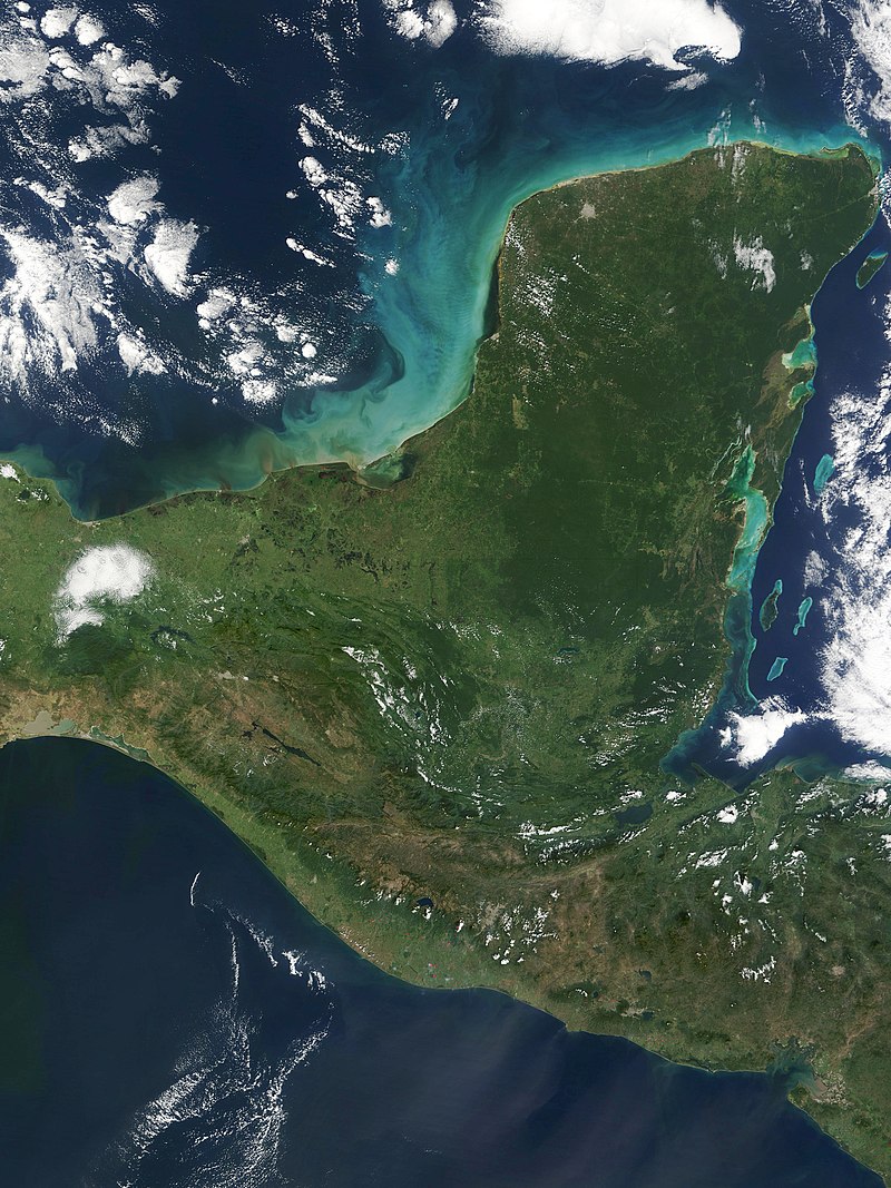
File:Yucatan_peninsula_250m.jpg · Wikimedia Commons · See Wikimedia Commons
Yucatan Peninsula
Sign in to saveAlso known as Yucatán Peninsula, Yucatan
peninsula in Central America
The Yucatan Peninsula is a large landmass in Central America that juts out into the Caribbean Sea and Gulf of Mexico. It is significant as the location of major ancient Mayan civilizations and today contains important archaeological sites, diverse ecosystems, and popular tourist destinations.
AI-generated from the Wikipedia summary — may contain errors.
Wikidata facts
- Instance of
- peninsula
- Country
- Guatemala
- Body of water
- Caribbean Sea
- Image
- Yucatan peninsula 250m.jpg
Show 4 more facts
- Commons category
- Yucatan Peninsula
- topic's main category
- Category:Yucatán Peninsula
- different from
- Yucatán
- on focus list of Wikimedia project
- Wikipedia:Vital articles/Level/4
Sources (3)
via Wikidata · CC0
~13 min read
Encyclopedic overview
The Yucatán Peninsula (/ˌjuːkəˈtɑːn, -ˈtæn/ YOO-kə-TA(H)N, UK also /ˌjʊk-/ YUU-; Spanish: Península de Yucatán [peˈninsula ðe ʝukaˈtan]) is a large peninsula in southeast Mexico and adjacent portions of Belize and Guatemala. The peninsula extends towards the northeast, separating the Gulf of Mexico to the north and west of the peninsula from the Caribbean Sea to the east. The Yucatán Channel, between the northeastern corner of the peninsula and Cuba, connects the two bodies of water.
The peninsula is approximately 181,000 km (70,000 mi) in area. It has low relief and is almost entirely composed of porous limestone.
Excerpted from Wikipedia’s “Yucatan Peninsula” article, available under the CC BY-SA 4.0 licence.
Gallery (10)
On the map
Available in 93 languages
- Español
- Français
- Deutsch
- 中文
- 日本語
- Русский
- Português
- Italiano
- العربية
- हिन्दी
- Afrikaans
- Amharic
- Armenian
- Asturian
- Azerbaijani
- Bahasa Indonesia
- Bashkir
- Basque
Show 74 more
- Bavarian
- be_x_old
- Belarusian
- Bosnian
- Breton
- Bulgarian
- Burmese
- Catalan
- Cebuano
- Croatian
- Czech
- Danish
- Esperanto
- Estonian
- Extremaduran
- Finnish
- Galician
- Georgian
- Greek
- Hakka Chinese
- Hebrew
- Hungarian
- Icelandic
- Ido
- Interlingua
- Interlingue
- Kazakh
- Kyrgyz
- Latin
- Latvian
- Lithuanian
- Low German
- Macedonian
- Malay
- Marathi
- Mazanderani
- Mingrelian
- Mongolian
- Nederlands
- Northern Frisian
- Norwegian
- Norwegian Nynorsk
- Occitan
- Ossetic
- Polski
- Quechua
- Romanian
- Saterland Frisian
- Scots
- Serbian
- Serbian (Latin)
- simple
- Slovak
- Slovenian
- Svenska
- Swahili
- Tamil
- Tatar
- Tiếng Việt
- Toki Pona
- Türkçe
- Ukrainian
- Urdu
- Uzbek
- Waray
- Welsh
- Western Frisian
- Wu Chinese
- Yakut
- Zaza
- zh_yue
- فارسی
- ไทย
- 한국어
via Wikidata sitelinks · CC0