Zealandia
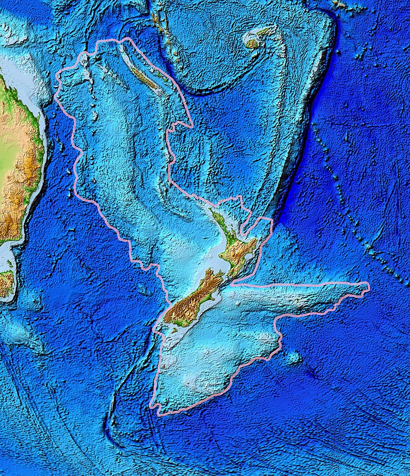
thumb|upright=1.35|Topography of Zealandia, outlined in pink. The linear [[ridges running north-northeast (Colville to the west and Kermadec to the east, separated by the Lau Basin) and southwest (the Resolution Ridge System) away from New Zealand are not considered part of Zealandia, nor are Australia (left), Vanuatu, or Fiji (top centre).]] thumb|upright=1.35|Map of New Caledonia and [[New Zealand, the two main areas that make up Zealandia]]
AI overview
Zealandia is a large submerged continental landmass located southeast of Australia that includes New Zealand and New Caledonia as its main above-water regions. Scientists consider it significant because it represents a distinct continent that is mostly underwater, challenging traditional understandings of Earth's continental geography.
AI-generated from the Wikipedia summary — may contain errors.
Article
8 sectionsContents
- Etymology
- Geology
- Biogeography
- Political divisions
- Population
- See also
- References
- External links
thumb|upright=1.35|Topography of Zealandia, outlined in pink. The linear [[ridges running north-northeast (Colville to the west and Kermadec to the east, separated by the Lau Basin) and southwest (the Resolution Ridge System) away from New Zealand are not considered part of Zealandia, nor are Australia (left), Vanuatu, or Fiji (top centre).]] thumb|upright=1.35|Map of New Caledonia and [[New Zealand, the two main areas that make up Zealandia]]
Zealandia (pronounced ), also known as (Māori) or Tasmantis (from Tasman Sea), is an almost entirely submerged mass of continental crust in Oceania that subsided after breaking away from Gondwana 83–79 million years ago. It has been described variously as a submerged continent, continental fragment, and microcontinent. The name and concept for Zealandia was proposed by Bruce Luyendyk in 1995, and satellite imagery shows it to be almost the size of Australia. A 2021 study suggests Zealandia is over a billion years old, about twice as old as geologists previously thought.