西兰大陆
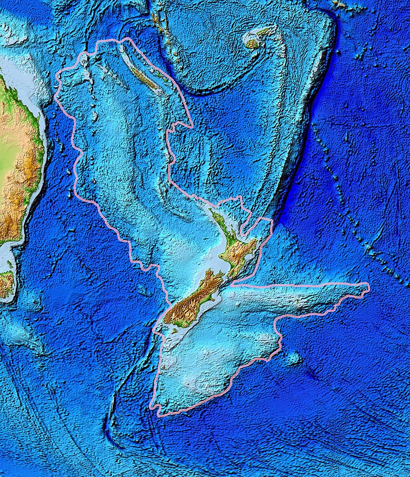
thumb|upright=1.35|Topography of Zealandia, outlined in pink. The linear [[ridges running north-northeast (Colville to the west and Kermadec to the east, separated by the Lau Basin) and southwest (the Resolution Ridge System) away from New Zealand are not considered part of Zealandia, nor are Australia (left), Vanuatu, or Fiji (top centre).]] thumb|upright=1.35|Map of New Caledonia and [[New Zealand, the two main areas that make up Zealandia]]
AI overview
Zealandia is a large submerged continental landmass located southeast of Australia that includes New Zealand and New Caledonia as its main above-water regions. Scientists consider it significant because it represents a distinct continent that is mostly underwater, challenging traditional understandings of Earth's continental geography.
AI-generated from the Wikipedia summary — may contain errors.
Wikidata facts
- Population
- 5200000
- Area
- 4900000
- Image
- Zealandia, topographic map.jpg
Show 2 more facts
- Commons category
- Zealandia
- Commons gallery
- Zealandia
Sources (2)
via Wikidata · CC0
Article · 中文
西蘭大陸(英語:Zealandia),也被稱為西蘭洲、西兰蒂亚和塔斯曼提斯(Tasmantis),是一塊幾乎被淹沒的大陆(submerged continent)。于8500萬到6000萬年前從包圍澳洲大陸的岡瓦那大陸分裂並分離,隨後沉入海底,面積490萬平方公里。此大陸目前有94%的區域已被海水淹沒,只有紐西蘭、新喀里多尼亞、諾福克島及一些其餘島嶼還浮於水面上,總面積大約490萬平方公里,等於三分之二的澳洲。
Abstract from DBpedia / Wikipedia · CC BY-SA
Gallery (16)
On the map
2 mapped locations