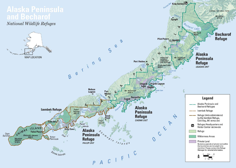
File:Map_Alaska_Peninsula_NWR.png · Wikimedia Commons · See Wikimedia Commons
Alaska Peninsula
Sign in to saveAlso known as Alaskan Peninsula
peninsula extending about 800 km (497 mi) to the southwest from the mainland of Alaska and ending in the Aleutian Islands
The Alaska Peninsula is a long strip of land stretching about 500 miles southwest from mainland Alaska until it reaches the Aleutian Islands. It serves as a geographical bridge connecting Alaska's mainland to the island chain that extends further into the North Pacific Ocean.
AI-generated from the Wikipedia summary — may contain errors.
Wikidata facts
- Instance of
- peninsula
- Country
- United States
- Located in
- Alaska
- Area
- 1500000
- Body of water
- Bering Sea
- Image
- State-of-Alaska-Map.png
- Length
- 800
Show 4 more facts
- Commons category
- Alaska Peninsula
- described by source
- Geographical statistical dictionary of the Russian Empire
- native label
- Alaska Peninsula
- on focus list of Wikimedia project
- Wikipedia:Vital articles/Level/4
Sources (2)
via Wikidata · CC0
~5 min read
Encyclopedic overview
Map of the Alaska Peninsula Volcanoes on the Alaska Peninsula Peulik Volcano and cottongrass meadow
The Alaska Peninsula (also called the Aleut Peninsula or the Aleutian Peninsula, Aleut: Alaxsxix̂; Sugpiaq: Aluuwiq, Al'uwiq) is a peninsula extending about 497 mi (800 km) to the southwest from the mainland of Alaska and ending in the Aleutian Islands. The peninsula separates the Pacific Ocean from Bristol Bay, an arm of the Bering Sea.
Excerpted from Wikipedia’s “Alaska Peninsula” article, available under the CC BY-SA 4.0 licence.
Gallery (8)
On the map
Available in 62 languages
- Español
- Français
- Deutsch
- 中文
- 日本語
- Русский
- Português
- Italiano
- العربية
- Armenian
- Asturian
- Azerbaijani
- Bahasa Indonesia
- Bangla
- Bashkir
- Basque
- Bavarian
- Belarusian
Show 43 more
- Bulgarian
- Catalan
- Cebuano
- Central Kurdish
- Croatian
- Czech
- Danish
- Esperanto
- Estonian
- Finnish
- Galician
- Georgian
- Greek
- Hebrew
- Hungarian
- Icelandic
- Kazakh
- Latin
- Latvian
- Lithuanian
- Malayalam
- Nederlands
- Norwegian Nynorsk
- Polski
- Romanian
- Serbian
- Serbian (Latin)
- simple
- Slovenian
- Swahili
- Tamil
- Tiếng Việt
- Türkçe
- Ukrainian
- Uzbek
- Waray
- West Flemish
- Western Frisian
- Wu Chinese
- zh_yue
- فارسی
- ไทย
- 한국어
via Wikidata sitelinks · CC0