File:Turkish_Strait_disambig.svg · Wikimedia Commons · See Wikimedia Commons
Also known as Bosphorus, Istanbul Strait, Thracian Bosporus, Bosporus Thracian, Strait of Istanbul
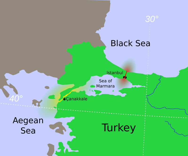
thumb|Location of the Bosporus (red) relative to the Dardanelles (yellow) and the [[Sea of Marmara]] thumb|Close-up satellite image of the Bosporus Strait, taken from the International Space Station in April 2004. The body of water at the top is the [[Black Sea, the one at the bottom is the Marmara Sea, and the Bosporus is the winding waterway that connects the two. The western banks of the Bosporus constitute the geographic starting point of the European continent, while the banks to the east are the geographic beginnings of the continent of Asia. The city of Istanbul is visible along both ba
The Bosporus Strait is a narrow waterway that connects the Black Sea to the Sea of Marmara, with Istanbul situated on its banks and the strait marking the geographic boundary between Europe and Asia. It matters because it serves as a crucial passageway for maritime traffic between these two regions and between the continents.
AI-generated from the Wikipedia summary — may contain errors.
via Wikipedia infobox
via Wikidata · CC0
O Bósforo (em turco: İstanbul Boğazı, em grego antigo: Βόσπορος) é um estreito que liga o mar Negro ao mar de Mármara e marca o limite dos continentes asiático e europeu na Turquia. Tem um comprimento de aproximadamente 30 km e uma largura de 550 a 3000 m. Sua profundidade varia de 36 a 124 m no meio do estreito. Seu nome significa "passagem do boi" (de Βοῦς (boi) e πόρος (passagem) e se refere à história de Io, jovem amada por Zeus, transformada por ele em boi, e perseguida por uma mosca sugadora de sangue enviada por Hera, que ficou ciumenta ao saber que Zeus amava outras pessoas. As margens do estreito são densamente povoadas, como exemplifica a cidade de Istambul. Duas pontes atravessam o estreito de Bósforo. A primeira, Ponte do Bósforo, tem 1 074 m e foi terminada em 1973. A segunda, Ponte Fatih Sultão Mehmet, tem 1 090 m e foi terminada em 1988, mais ou menos a 5 km ao norte da primeira ponte. Marmaray, um túnel ferroviário de 13,7 km foi inaugurado em 29 de outubro de 2013. Aproximadamente 1 400 m de túnel passam sob o estreito, a uma profundidade de 55 m.
Abstract from DBpedia / Wikipedia · CC BY-SA
31 mapped locations
Discovered by embedding cosine similarity (sentence-transformers MiniLM, 384-dim).