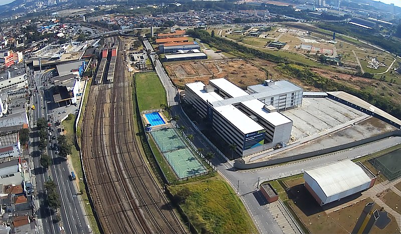
File:CarapicuibaCentro.jpg · Wikimedia Commons · See Wikimedia Commons
In the Vinony graph
Within Vinony's link graph, Carapicuíba is referenced by 412 other articles, and connects out to Santana de Parnaíba, Brazil and Christianity.
The entry is geolocated on the map.
Vinony files it under Carapicuíba and Populated places established in 1580.
Its subject is documented across 42 Wikipedia language editions.
Key facts
- Settlement.official_name
- Municipality of Carapicuíba
- Settlement.nickname
- Brazilian capital of selfies
- Settlement.image_skyline
- CarapicuibaCentro.jpg
- Settlement.image_caption
- Downtown Carapicuíba.
- Settlement.image_flag
- Bandeira de Carapicuiba.svg
- Settlement.image_shield
- Brasão Carapicuiba.svg
- Settlement.image_map
- SaoPaulo Municip Carapicuiba.svg
- Settlement.pushpin_map
- Brazil
- Settlement.pushpin_label
- Carapicuíba
- Settlement.map_caption
- Location in the state of São Paulo and Brazil
- Settlement.subdivision_type
- Country
- Settlement.subdivision_name
- Brazil
- Settlement.subdivision_type1
- Region
- Settlement.subdivision_name1
- Southeast
- Settlement.subdivision_type2
- State
- Settlement.subdivision_name2
- São Paulo
- Settlement.subdivision_type3
- Metropolitan Region
- Settlement.subdivision_name3
- São Paulo
via Wikipedia infobox
Wikidata facts
- Instance of
- big city
- Demonym
- carapicuibano
- Country
- Brazil
- Located in
- São Paulo
- Population
- 283661
- Area
- 34.967
- Elevation
- 762
- Shares border with
- Jandira
- Official website
- www.carapicuiba.sp.gov.br
- Image
- CarapicuibaCentro.jpg
- Dialing code
- 11
Show 7 more facts
- topic's main category
- Category:Carapicuíba
- Commons category
- Carapicuíba
- twinned administrative body
- Menaggio
- electorate
- 297191
- Human Development Index
- 0.749
- postal code
- 06300-000 até 06399-999
- inception
- 1580-01-01
Sources (6)
via Wikidata · CC0
~6 min read
Encyclopedic overview
11 sectionsContents
- History
- Origin of the name
- Geography
- Economy
- Media
- Transportation
- Highways
- Notable people
- See also
- References
- External links
Carapicuíba () is a municipality in the state of São Paulo in Brazil. It is part of the Metropolitan Region of São Paulo. The population is 403,183 (2020 est.) in an area of . It is one of the most densely populated municipalities in the state of São Paulo.
== History == The region which today is Carapicuíba was inhabited by indigenous people before the arrival of European settlers. The hamlet was founded by José de Anchieta. Afonso Sardinha settled there with his farm with the will to use the indigenous people as a workforce. He then built a chapel. The indigenous people soon reacted to the European occupation, and rushed into the jungle. By the 17th century, it was part of the recently created municipality of Santana do Parnaíba. Nothing much has changed in the hamlet during this century and most of the 18th century.
Excerpted from Wikipedia’s “Carapicuíba” article, available under the CC BY-SA 4.0 licence.