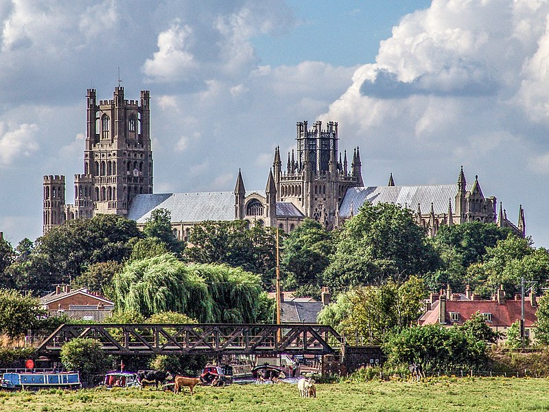
File:Ely-071.jpg · Wikimedia Commons · See Wikimedia Commons
Also known as Ely, Cambridgeshire
город в Англии
OverviewAI-generated
Ely is a city and civil parish located in East Cambridgeshire, England, within the United Kingdom. It serves as the capital of the East Cambridgeshire district. The city is situated next to the River Great Ouse and shares a border with Little Downham. Its postal codes are CB6 and CB7, and its local dialing code is 01353.
The area of Ely is 23. Population figures vary by source, with one listing 20,574 residents and another recording 19,090. The city has an elevation of 23 and is in the Europe/London timezone. Ely is twinned with Ribe.
Synthesized by Vinony from 52 facts across 7 sources: Wikidata, Open Meteo, Openweathermap, OpenStreetMap, GeoNames, Vinony graph, Geo. Generated from structured data (not the Wikipedia text) and checked against those facts — may still contain errors.
Weather now
7-day forecast
via Open-Meteo
Place details
- Locality
- Ely
- Region
- England
- Country
- United Kingdom
- Population
- 20,574
- Timezone
- Europe/London
via OpenStreetMap · GeoNames
Wikidata facts
- Instance of
- civil parish
- Official name
- Ely
- Country
- United Kingdom
- Located in
- East Cambridgeshire
- Population
- 11291
- Area
- 23
- Body of water
- River Great Ouse
- Capital of
- East Cambridgeshire
- Shares border with
- Little Downham
- Official website
- www.cityofelycouncil.org.uk
- Image
- Ely-071.jpg
- Dialing code
- 01353
Show 11 more facts
- Commons category
- Ely, Cambridgeshire
- postal code
- CB7
- topic's main category
- Category:Ely, Cambridgeshire
- twinned administrative body
- Ribe
- category for people born here
- Q8733281
- category of associated people
- Category:People from Ely, Cambridgeshire
- OS grid reference
- TL5379
- native label
- Ely
- Commons gallery
- Ely
- P8168
- M39
- P12749
- Masashi Kishimoto
Sources (8)
via Wikidata · CC0
Article · Русский
И́ли (англ. Ely [ˈiːli]) — соборный город в графстве Кембриджшир Англии со статусом сити, административный центр района Ист-Кембриджшир. Расположен в 23 км к северо-востоку от Кембриджа. Или неофициально считается резиденцией епархии, утверждённой Королевской Грамотой в 1974 году. В то время приходский совет графства был сформирован в процессе реорганизации местной администрации. По населению Или является третьим из самых маленьких городов Англии (после Уэлса, что в графстве Сомерсет, и Лондонского Сити) и шестым во всей Великобритании (меньше его также города Сент-Дейвидс, и Арма).
Abstract from DBpedia / Wikipedia · CC BY-SA
Gallery (12)
On the map
Available in 66 languages
- Español
- Français
- Deutsch
- 中文
- 日本語
- Русский
- Português
- Italiano
- العربية
- Armenian
- azb
- Bahasa Indonesia
- Bangla
- Basque
- Belarusian
- Breton
- Bulgarian
- Catalan
Show 47 more
- Cebuano
- Croatian
- Czech
- Danish
- Egyptian Arabic
- Estonian
- Filipino
- Finnish
- Greek
- Hausa
- Hebrew
- Icelandic
- Interlingue
- Irish
- Kurdish
- Latin
- Latvian
- Lithuanian
- lld
- Manipuri
- Mazanderani
- Nederlands
- Northern Frisian
- Norwegian
- Norwegian Nynorsk
- Old English
- Ossetic
- Polski
- Romanian
- Scottish Gaelic
- Serbian (Latin)
- simple
- Slovak
- Slovenian
- Svenska
- Türkçe
- Ukrainian
- Urdu
- Waray
- Welsh
- Western Panjabi
- Wu Chinese
- Zaza
- zh_min_nan
- zh_yue
- فارسی
- 한국어
via Wikidata sitelinks · CC0