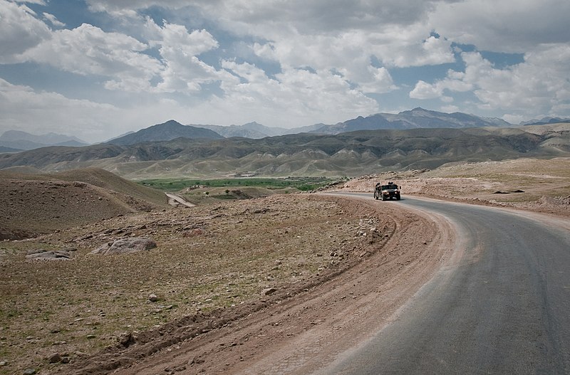
File:Tagab_Valley_in_Kapisa_Province.jpg · Wikimedia Commons · See Wikimedia Commons
Kapisa Province is a region in Afghanistan located in the north-central part of the country. It matters because it is strategically positioned in Afghanistan's geography and has been significant in the country's political and military history.
AI-generated from the Wikipedia summary — may contain errors.
Wikidata facts
- Instance of
- province of Afghanistan
- Country
- Afghanistan
- Located in
- Afghanistan
- Contains
- Tagab
- Capital
- Mahmude Raqi
- Official language
- Pashto
- Population
- 399500
- Area
- 1842
- Elevation
- 1746
- Time zone
- UTC+04:30
- Shares border with
- Laghman Province
- Image
- Tagab Valley in Kapisa Province.jpg
Show 5 more facts
- Commons category
- Kapisa Province
- topic's main category
- Category:Kapisa Province
- office held by head of government
- governor
- category of associated people
- Category:People from Kapisa Province
- native label
- کاپیسا
Sources (8)
via Wikidata · CC0
~26 min read
Encyclopedic overview
Kapisa is the smallest of the 34 provinces of Afghanistan, located in the northeastern part of the country. It has an estimated population of 523,201 people and an area of 1,842 km (711 sq mi), making it the most densely populated province apart from Kabul Province. It borders Panjshir Province to the north, Laghman Province to the east, Kabul Province to the south and Parwan Province to the west. Mahmud-i-Raqi is the provincial capital, while the most populous city and district of Kapisa is Nijrab.
History
Excerpted from Wikipedia’s “Kapisa Province” article, available under the CC BY-SA 4.0 licence.
Gallery (12)
On the map
Available in 70 languages
- Español
- Français
- Deutsch
- 中文
- 日本語
- Русский
- Português
- Italiano
- العربية
- हिन्दी
- Asturian
- azb
- Azerbaijani
- Bahasa Indonesia
- Bangla
- Basque
- be_x_old
- Belarusian
Show 51 more
- Bulgarian
- Catalan
- Cebuano
- Central Kurdish
- Crimean Tatar
- Czech
- Danish
- Esperanto
- Estonian
- Filipino
- Finnish
- Georgian
- Greek
- Hebrew
- Latvian
- Lithuanian
- Malay
- Mazanderani
- Minangkabau
- Mongolian
- Nederlands
- Newari
- Northern Frisian
- Norwegian
- Ossetic
- Pashto
- Polski
- Punjabi
- Romanian
- Scots
- Serbian
- Serbian (Latin)
- simple
- Sindhi
- Sundanese
- Svenska
- Tajik
- Tamil
- Türkçe
- Ukrainian
- Urdu
- Uyghur
- Uzbek
- Waray
- Welsh
- Western Panjabi
- Wu Chinese
- zh_min_nan
- zh_yue
- فارسی
- 한국어
via Wikidata sitelinks · CC0