File:Karwar_Evening.jpg · Wikimedia Commons · See Wikimedia Commons
Karwar
Sign in to saveAlso known as Carwar
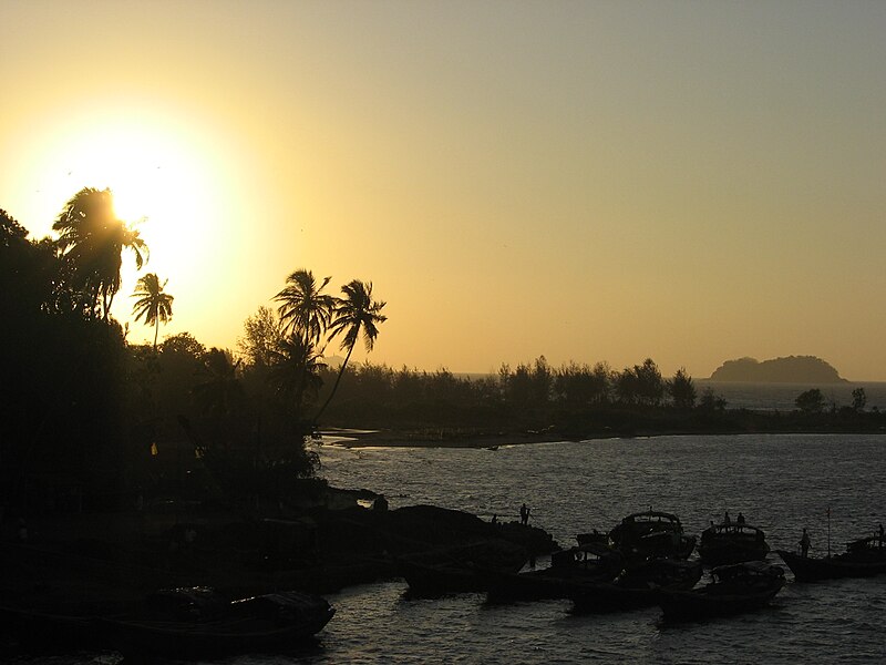
Karwar is a coastal city and the administrative headquarters of Uttara Kannada district, formerly part of the Bombay Presidency, located at the mouth of the Kali river along the Konkan Coast in the present-day state of Karnataka, India.
Weather now
cached 19h ago7-day forecast
via Open-Meteo
Place details
- Locality
- Karwar
- Region
- Karnataka
- Country
- India
- Population
- 77,139
- Timezone
- Asia/Kolkata
via OpenStreetMap · GeoNames
Key facts
- Settlement.name
- Karwar
- Settlement.native_name_lang
- Konkani
- Settlement.other_name
- Carwar, Koney
- Settlement.settlement_type
- Municipality /Taluk
- Settlement.image_size
- 300px
- Settlement.image_caption
- Clockwise from the Top: Tagore Beach, Arabian Sea from Sadashivgad fort, Majali Beach, Bridge over Kali River, Rabindranath Tagore Beach
- Settlement.mapframe
- yes
- Settlement.mapframe zoom
- 6
- Settlement.map_caption
- Karwar in Karnataka
- Settlement.subdivision_type
- Country
- Settlement.subdivision_type1
- State
- Settlement.subdivision_name1
- Karnataka
- Settlement.subdivision_type3
- District
- Settlement.subdivision_name3
- Uttara Kannada
- Settlement.established_date
- 1867
- Settlement.government_type
- City Municipal Council
- Settlement.leader_title2
- President
- Settlement.leader_title3
- Uttara Kannada
via Wikipedia infobox
Wikidata facts
- Area
- 27.9
- Elevation
- 9
- Image
- Karwar Railway Station.jpg
- Dialing code
- 8382
- Licence plate code
- KA-30
Show 3 more facts
- Commons category
- Karwar
- postal code
- 581301
- name in native language
- ಕಾರವಾರ
via Wikidata · CC0
Travel guide
Get around
Auto rickshaw, or car. You can also rent a boat to visit some of the islands. For the environment-friendly, bicycles are also available on Rent basis. Bicycles in the standard non-geared, and now MTBs are also available.
See
Beaches, Islands and mangrove up on the Kali river.
Sadashivgad Sadashivgad is a fort located in Karwar, Uttara Kannada district, in the state of Karnataka in India. Significant and picturesque, the fort is now a popular tourist destination located by the Kali river bridge, which has been built at the confluence of the river and the Arabian Sea. Konkani is spoken as a local language. The fort was built on an old fortified site on the north bank of Kali River where it meets the sea. It had about 8 meters high ramparts which were about 2 metres wide at the top. There were towers and openings for guns. The citadel was at the highest point. An outwork was on the west, near the sea at the base of the cliff and was appropriately called Pani Killa. There was another outwork on the eastern slope. The citadel had single arched gateway. Samvargad was a very small fort, about 60 metres by 20 metres on top of a hillock east of Sadashivgad. It was a satellite fort guarding the former on its east & north east. Very few ruins remain. The fort was named Sadashivgad by Basavlingraj after his father Sadashivlingraj in 1715. They were chieftains of Sonda who assumed the title of 'Raja' after incorporating Chittakula, Simveshwar (Angadi), Kadra, Kadwad, Ankola and some other parts of Canara. The old Karwar fort was pulled down and its material used to build Sadashivgad. The fort is in ruins as most of it was pulled down by East India Company General Matthews in 1783. A road now runs between it …
Do
Beautiful beaches, snorkeling, banana boating
Buy
there are small pan stalls, chat stalls, etc.
Eat
Sea Food and some local restaurants, "Gadbad" Icecream.
Some of the famous local restaurants include:
Poornima Restaurant, Main Road, Karwar. (Veg - Moderate expense) Premier Hotel, Green Street, Karwar. (Non-Veg - Expensive) Amruth Bar & Restaurant, Main Road Karwar. (Non-Veg - Moderate) Parvati Fish Land (Non-Veg - Moderate - Fish/Sea Food) Shweta Lunch Home (Non-Veg - Moderate - Fish/Sea Food)
Drink
Tender coconut, Soda Sharbath at local cold drinks shop
Sleep
Devbagh beach resort. Somewhat pricey, but the beach is quite brilliant, as is the nature walk they provide around the resort, through mangrove forests among other things. Don't miss the quicksand!
Connect
By B.S.N.L mobile network which is widely spread
Go next
Sirsi Anshi National Park Mangalore
Kumta - 75 km from here. Honavar - 95 km from here. Gokarna - 75 km from here.
Travel guide from Wikivoyage (CC BY-SA 4.0)
~22 min read
Article
38 sectionsContents
- Etymology
- History
- Ancient history
- Post-Independence
- Geography
- Biodiversity
- Climate
- Demographics
- Border issues
- Religion
- Industry
- Primary industry
- Secondary industry
- Tertiary industry
- INS Kadamba
- INS Vajrakosh
- Aditya Birla Chemicals
- Transport
- Karwar International Airport
- Konkan railway
- Port
- Tourism
- Rabindranath Tagore beach
- Places of interest
- Seaside
- Hinterland
- Historic sites
- Educational tourism
- Culture
- Cuisine
- Local festivals
- Media
- Education
- Notable residents
- Villages of Karwar
- See also
- References
- External links
Karwar is a coastal city and the administrative headquarters of Uttara Kannada district, formerly part of the Bombay Presidency, located at the mouth of the Kali river along the Konkan Coast in the present-day state of Karnataka, India.
== Etymology == Karwar, also known locally as "Kādwād", derived its name from the nearby village of "Kade-Wādā". In the local Konkani, Kade means "Last" and Wādā means "Ward". Hence, Kade-Wādā ("the last neighbourhood") referred to the southernmost Konkani-speaking village. During the Crown rule in India, the name "Karwar" was spelt as "Carwar". The ancient name was "Baithkhol"—from an Arabic term Bait-e-kol— meaning the "bay of safety". This is in the Indian history for maritime trade wherein black peppercorns, cardamom, and muslin cloth were exported from this Kādwād port and after the war with Veer Henja Naik (1803), the port activities were shifted to Baithkhol. Thereafter, the port of Kādwād was isolated and Kurmagad Fort was activated by the Portuguese.
Gallery (44)
On the map
3 mapped locations