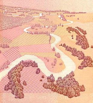
File:Nemunas_loops_-_500_litai.jpg · Wikimedia Commons · See Wikimedia Commons
Nemunas
Sign in to saveAlso known as Nyoman, Niemen, Memel, Nioman, Neman River
fiume che attraversa la Bielorussia, la Lituania e la Russia
The Neman is a major river in Eastern Europe that originates in Belarus, flows through Lithuania, and forms the northern border of Russia's Kaliningrad region before emptying into the Baltic Sea. It matters as a significant waterway and geographical feature that crosses multiple countries and defines regional boundaries.
AI-generated from the Wikipedia summary — may contain errors.
Key facts
- River.name
- Neman
- River.name_other
- NemunasNiemen
- River.name_etymology
- possible Slavic word for monster
- River.image
- Neman river.jpg
- River.image_size
- 300
- River.image_caption
- Neman near Alytus
- River.map
- Nemunas-en.png
- River.map_size
- 300
- River.map_caption
- Map highlighting Neman
- River.pushpin_map_size
- 300
- River.mapframe
- yes
- River.mapframe zoom
- 5
- River.subdivision_type1
- Country
- River.subdivision_name1
- Belarus, Lithuania, Russia
- River.subdivision_type5
- Cities
- River.subdivision_name5
- Stowbtsy, Grodno, Druskininkai, Alytus, Birštonas, Prienai, Kaunas, Jurbarkas, Sovetsk
- River.discharge1_location
- Curonian Lagoon, linked to the Baltic Sea
- River.source1_location
- Southwest of Minsk, Belarus
via Wikipedia infobox
Wikidata facts
- Instance of
- transboundary river
- Country
- Russia
- Located in
- Minsk Region
- Continent
- Europe
- Image
- 2025-07-02 Nemunas Litovio ZvD 10.jpg
- Length
- 937
Show 11 more facts
- Commons category
- Neman
- mouth of the watercourse
- Baltic Sea
- topic's main category
- Category:Neman
- category for the water basin
- Category:Neman basin
- watershed area
- 98200
- discharge
- 678
- basin country
- Poland
- different from
- Niemen
- P6482
- Neman
- waterbody number
- LT/10010001
- distributary
- Atmata
via Wikidata · CC0
Article · Italiano
Il Nemunas (dal lituano; in tedesco: Memel; in russo: Неман?, Neman; in bielorusso: Нёман, Njoman; in polacco: Niemen, in jidisch: נעמאן Neman o מעמל Meml) è un fiume lungo 937 km che attraversa la Bielorussia, la Lituania e la Russia. La sua lunghezza complessiva è di 937 km, che ne fa (in termini di lunghezza) il quarto fiume più lungo del bacino del mar Baltico. Scorre per 459 km in Bielorussia e per 359 km in Lituania; 116 km del suo percorso rappresentano il confine tra la Lituania e l'exclave russa dell'oblast' di Kaliningrad. La profondità massima è pari a 5 m e il punto più largo è pari a circa 500 m, la sua velocità va dagli 1 ai 2 m/s. Ha circa 105 tributari maggiori, i principali sono il Neris (lungo 510 km), il Čara (325 km) e lo Šešupė (298 km).
Abstract from DBpedia / Wikipedia · CC BY-SA
Gallery (29)
On the map
6 mapped locations
Available in 79 languages
- Español
- Français
- Deutsch
- 中文
- 日本語
- Русский
- Português
- Italiano
- العربية
- Afrikaans
- Armenian
- azb
- Bahasa Indonesia
- Bashkir
- Basque
- bat_smg
- be_x_old
- Belarusian
Show 60 more
- Breton
- Bulgarian
- Catalan
- Cebuano
- Chuvash
- Croatian
- Czech
- Danish
- Egyptian Arabic
- Esperanto
- Estonian
- Filipino
- Finnish
- Galician
- Georgian
- Greek
- Hebrew
- Hungarian
- Ido
- Kazakh
- Kotava
- Kurdish
- Kyrgyz
- Latin
- Latvian
- Lithuanian
- lld
- Low German
- Macedonian
- Malagasy
- Malayalam
- Mari
- Mingrelian
- Mongolian
- Nederlands
- Norwegian
- Norwegian Nynorsk
- olo
- Ossetic
- Polski
- Romanian
- Sanskrit
- Serbian
- Serbian (Latin)
- simple
- Slovak
- Slovenian
- Svenska
- Tatar
- Tiếng Việt
- Türkçe
- Ukrainian
- Upper Sorbian
- Uzbek
- Walloon
- Western Frisian
- Wu Chinese
- Yiddish
- فارسی
- 한국어
via Wikidata sitelinks · CC0