Quetzaltenango
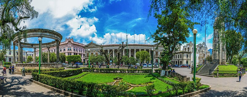
Quetzaltenango (, also known by its Maya name Xelajú or Xela ) is a municipality and namesake department in western Guatemala. The city is located in a mountain valley at an elevation of above sea level at its lowest part. Inside the city, it can reach above .
AI overview
Quetzaltenango is a city and department in western Guatemala situated in a mountainous valley at a high elevation. It is also known by its Maya name, Xelajú or Xela, and serves as the namesake for its surrounding department.
AI-generated from the Wikipedia summary — may contain errors.
Key facts
- Settlement.name
- Quetzaltenango
- Settlement.settlement_type
- Municipality and city
- Settlement.pushpin_map
- Guatemala#Guatemala Quetzaltenango
- Settlement.pushpin_relief
- a
- Settlement.pushpin_label_position
- bottom
- Settlement.pushpin_map_caption
- Location in Guatemala
- Settlement.subdivision_type
- Country
- Settlement.subdivision_type1
- Department
- Settlement.subdivision_name1
- 25px Quetzaltenango
- Settlement.subdivision_type2
- Municipality
- Settlement.government_type
- Municipality
- Settlement.leader_title
- Mayor
Article
13 sectionsContents
- Etymology
- History
- Climate
- Economy
- Sports
- Transportation
- Education
- People born in Quetzaltenango
- Consular representations
- Twin towns – sister cities
- See also
- References
- External links
Quetzaltenango (, also known by its Maya name Xelajú or Xela ) is a municipality and namesake department in western Guatemala. The city is located in a mountain valley at an elevation of above sea level at its lowest part. Inside the city, it can reach above .
Quetzaltenango is a part of the , which also includes the municipalities of Salcajá, Cantel, Almolonga, Zunil, Concepción Chiquirichapa, San Mateo, La Esperanza, San Juan Ostuncalco, Olintepeque, San Miguel Sigüilá, and Cajolá in Quetzaltenango Department, as well as San Cristóbal Totonicapán and San Andrés Xecul in Totonicapán Department.