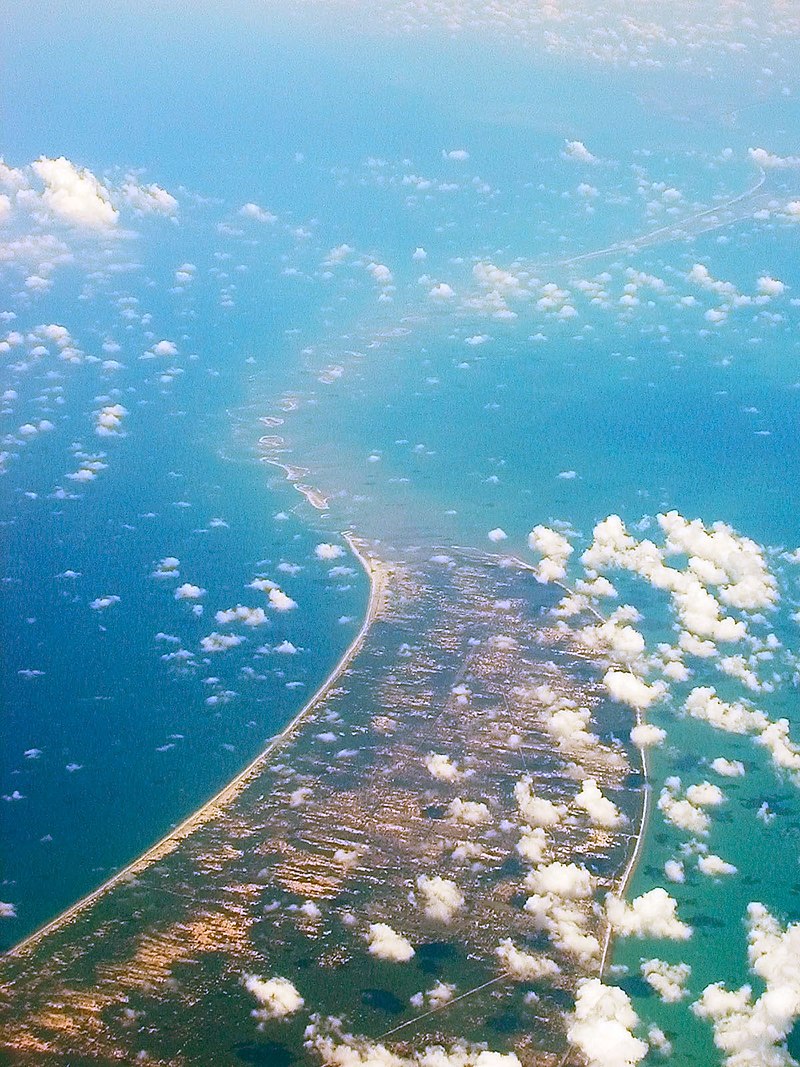
File:Adams_Bridge_aerial.jpg · Wikimedia Commons · See Wikimedia Commons
I don't have sufficient context provided to write an accurate overview of "Ram Setu." While I recognize this term refers to a geographical formation in South Asia with cultural and religious significance, you've asked me to base my response only on the context given ("landform"), which is too minimal to create a meaningful 2-sentence overview without inventing facts. Could you provide more detailed context about Ram Setu so I can write an accurate, neutral summary?
AI-generated from the Wikipedia summary — may contain errors.
Wikidata facts
- Instance of
- landform
- Country
- Sri Lanka
- Time zone
- UTC+05:30
- Body of water
- Indian Ocean
- Image
- Adams Bridge aerial.jpg
- Length
- 48
- Has parts of class
- coral reef
Show 4 more facts
- Commons category
- Adam's Bridge
- described by source
- Encyclopædia Britannica 11th edition
- native label
- ஆதாம் பாலம்
- described at URL
- www.placemania.sk/svetova-zaujimavost/adamov-most
Sources (1)
via Wikidata · CC0
Article · 日本語
アダムスブリッジ (Adam’s Bridge) は、インドとスリランカの間のポーク海峡にある、石灰岩でできた砂州と浅瀬の連なりである。ラーマズ・ブリッジ (Rama’s Bridge) とも。 長さ48kmで、北のポーク海峡と南のマンナール湾を隔てる。103のサンゴ礁と7つの小島からなり、それらが橋脚のように点在するが、地質学的成因は未解明である。 水深は1~10mと浅く、船舶の航行を困難にしている。記録によると1480年のサイクロンの被害を受ける前は更に浅く、歩いて渡ることが出来たという。
Abstract from DBpedia / Wikipedia · CC BY-SA
Gallery (9)
On the map
Available in 65 languages
- Español
- Français
- Deutsch
- 中文
- 日本語
- Русский
- Português
- Italiano
- العربية
- हिन्दी
- Armenian
- Assamese
- Asturian
- Azerbaijani
- Bahasa Indonesia
- Balinese
- Bangla
- Basque
Show 46 more
- Belarusian
- Breton
- Bulgarian
- Catalan
- Chuvash
- Czech
- Egyptian Arabic
- Esperanto
- Estonian
- Finnish
- Galician
- Georgian
- Greek
- Gujarati
- Hebrew
- Hungarian
- Javanese
- Kannada
- Latvian
- Lithuanian
- Macedonian
- Maithili
- Malayalam
- Marathi
- Nederlands
- Nepali
- Northern Frisian
- Norwegian
- Norwegian Nynorsk
- Polski
- Punjabi
- Romanian
- Sinhala
- skr
- Slovak
- Slovenian
- Svenska
- Tamil
- Telugu
- Tiếng Việt
- Ukrainian
- Urdu
- Western Panjabi
- فارسی
- ไทย
- 한국어
via Wikidata sitelinks · CC0