
Solomon Islands
Sign in to saveAlso known as sb, SOL
Solomon Islands, also known simply as the Solomons, is an archipelagic country consisting of six major islands and over 1,000 smaller islands in Melanesia, Oceania, to the north-east of Australia. It is adjacent to Bougainville to the west, New Caledonia and Vanuatu to the south-east, Fiji, Tuvalu, and Wallis and Futuna to the east, and the Federated States of Micronesia and Nauru to the north. It has a total area of 28,896 square kilometres, and a population of 828,857 according to the official estimates from 2025. Its capital and largest city, Honiara, is located on the largest island, Guadalcanal. The country takes its name from the wider area of the Solomon Islands archipelago, which is a collection of Melanesian islands that also includes the Autonomous Region of Bougainville, but excludes the Santa Cruz Islands.
OverviewAI-generated
The Solomon Islands is an island country and sovereign state located in Oceania, specifically within the Melanesia subregion. Its capital is Honiara. The nation is a Commonwealth realm with Charles III as head of state. English is the official language, and the currency is the Solomon Islands dollar. The country’s top-level Internet domain is .sb.
The population is recorded at 750,325 or 819,198 depending on the source. The land area covers 28,896 square kilometers. The highest point is Mount Popomanaseu. The country contains administrative entities including Central Province, Choiseul Province, Guadalcanal Province, and Honiara. It is a member of the United Nations, the Commonwealth of Nations, and the World Trade Organization. The anthem is God Save Our Solomon Islands.
Approximately 90.06 percent of the land is forested. The urban population percentage is 30.66. Life expectancy is 70.69 years. The unemployment rate is 1.431 percent. The country operates in the UTC+11:00 time zone. Its telephone country code is +677.
Synthesized by Vinony from 69 facts across 9 sources: Wikidata, Open Meteo, Openweathermap, World Bank, OpenStreetMap, Firecrawl, REST Countries, Vinony graph, Geo. Generated from structured data (not the Wikipedia text) and checked against those facts — may still contain errors.
In the Vinony graph
Solomon Islands appears in Vinony's Countries collection — one of 215 entries.
Within Vinony's link graph, Solomon Islands is referenced by 9,514 other articles, and connects out to French Polynesia, climate change and Austronesian.
The entry is geolocated on the map in city, across 2 mapped points.
It is catalogued under topics including 1978 establishments in the Solomon Islands, British Western Pacific Territories and Countries and territories where English is an official language.
Weather now
cached 11h ago7-day forecast
via Open-Meteo
Country
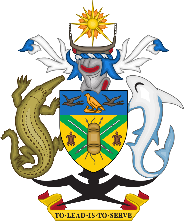
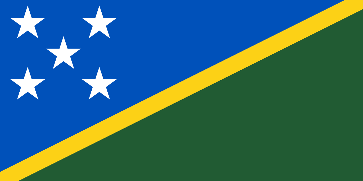
- Capital
- Honiara
- Population
- 750,325
- Region
- Oceania · Melanesia
- Demonym
- Solomon Islander
- Currencies
- SBD ($)
- Languages
- English
- Calling code
- +677
- Drives on
- Left
- Gini
- 37.1 (2012)
- FIFA code
- SOL
- TLD
- .sb
- Timezones
- UTC+11:00
via REST Countries
Indicators · World Bank
- GDP
- $1.6B(2024)
- Population
- 819,198(2024)
- Life expectancy
- 70.7 yrs(2024)
- Unemployment
- 1.4 %(2025)
- Urban population
- 30.7 %(2024)
- Internet users
- 29 %(2024)
- Forest area
- 90.1 %(2023)
- Renewable energy
- 50.1 %(2022)
via World Bank Open Data · CC BY 4.0
Wikipedia views (30d)
61,882 totalvia Wikimedia Pageviews API
Official website
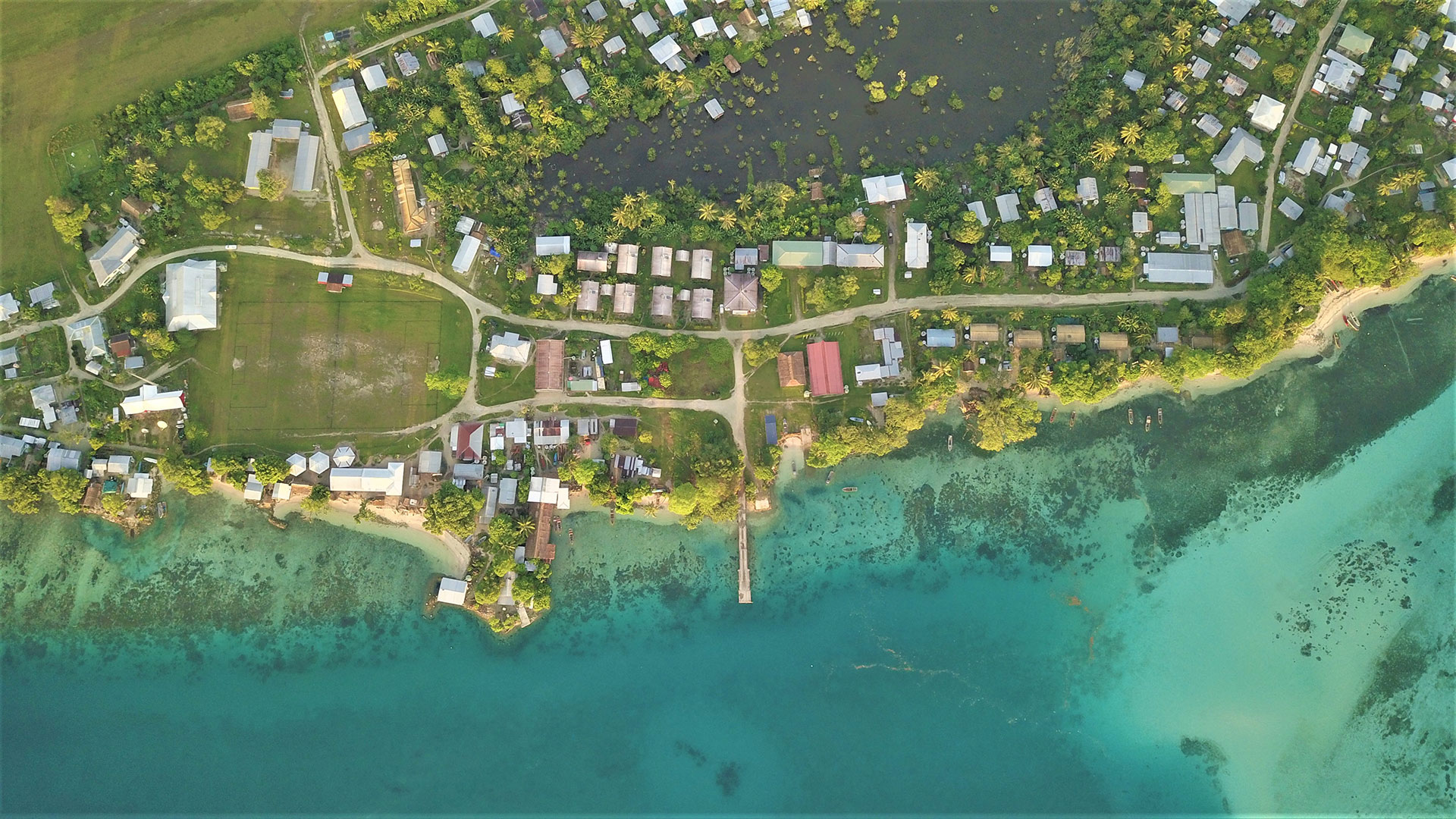
Solomon Islands Government Services Portal
The Solomon Islands Government Services Portal is a combination of ‘General Information’ on all Ministries, Departments and Agencies.
solomons.gov.sb →Link to the official site · 30,517 chars · not written by Vinony
Wikidata facts
- Instance of
- archipelagic state
- Part of
- Melanesia
- Named after
- Solomon
- Official name
- Solomon Islands
- Demonym
- صالومونييات
- Country
- Solomon Islands
- Contains
- Central Province
- Continent
- Insular Oceania
- Capital
- Honiara
- Official language
- English language
- Population
- 611343
- Area
- 28400.0
- Head of government
- Jeremiah Manele
- Head of state
- Charles III
- Legislature
- National Parliament of Solomon Islands
- Shares border with
- France
- Highest point
- Mount Popomanaseu
- Official website
- solomons.gov.sb
- Image
- Solomon Islands - Location Map (2012) - SLB - UNOCHA.svg
- Life expectancy
- 71
- Nominal GDP
- 1595710784
- Unemployment rate
- 4
- Calling code
- +677
Show 54 more facts
- Electrical plug type
- BS 1363
- Mains voltage
- 220
- Motto
- A fo ben, bid bont
- Coat of arms
- coat of arms of the Solomon Islands
- Commons category
- Solomon Islands
- top-level Internet domain
- .sb
- topic's main category
- Category:Solomon Islands
- category for people who died here
- Category:Deaths in the Solomon Islands (archipelago)
- category of associated people
- Category:Solomon Islands people
- diplomatic relation
- China
- IPA transcription
- ˈsɑːlumunœɪənə
- lowest point
- Pacific Ocean
- mobile country code
- 540
- driving side
- left
- geography of topic
- geography of the Solomon Islands
- emergency phone number
- 999
- marriageable age
- 18
- topic's main Wikimedia portal
- Portal:Solomon Islands
- category for people born here
- Category:Births in the Solomon Islands
- office held by head of government
- Prime Minister of the Solomon Islands
- language used
- Amba
- number of out-of-school children
- 48080
- has characteristic
- free country
- located in/on physical feature
- Melanesia
- total fertility rate
- 3.966
- maritime identification digits
- 557
- inception
- 1978-01-01
- Unicode character
- 🇸🇧
- central bank
- Central Bank of Solomon Islands
- category for films shot at this location
- Category:Films shot in the Solomon Islands
- described by source
- Encyclopædia Britannica 11th edition
- history of topic
- history of the Solomon Islands
- different from
- Solomon Islands
- native label
- Solomon Islands
- replaces
- British Solomon Islands
- economy of topic
- economy of Solomon Islands
- demographics of topic
- demographics of the Solomon Islands
- Human Development Index
- 0.564
- P11012
- demographics of Russia
- hashtag
- SolomonIslands
- on focus list of Wikimedia project
- Wikipedia:Vital articles/Level/4
- Gini coefficient
- 37.1
- Inequality-adjusted Human Development Index
- 0.430
- P12749
- Jean-Baptiste Lully
- birth rate
- 29.322
- male population
- 369899
- death rate
- 4.888
- rural population
- 538975
- female population
- 354373
- urban population
- 185298
- P8168
- Izanagi Plate
- Commonwealth Sport country code
- SOL
Sources (15)
via Wikidata · CC0
Travel guide
Get in
thumb|375px|Yellow: visa on arrival; green: visa free access
See
thumb|300px|Children in Tuo Village, Fenualoa
Highlights include the lovely and huge Lake Te'Nggano, dramatically surrounded by high cliffs, once the reefs around this old lagoon.
Even more famous is the Langa Langa Lagoon, whose waters are brown rather than bright blue, life here is slow and peaceful, with locals working on their traditional handicrafts and classic canoes making their silent way through the water.
It's also one of the places where you can see the artificial islands this country is known for. Some date back to the 16th century, but new ones are created even now, using stones and coral materials.
Follow the slightly challenging but beautiful path to the bubbling mud of the Reoka hot springs or, for serious hikers, consider a 2-day hike to the top of the volcano Kolombangara. Easier but more beautiful is the path to the Mataniko Falls, with underlying caves that served as a hide-out for soldiers in World War II, and the Tenaru Falls. They are close to Honiara, the country's capital, and also home to the National Museum and Culture Centre.
East Rennell is the largest raised coral atoll in the world and a UNESCO World Heritage Site.
Skull Island is a tiny islet is accessible from Lola Island, which is one of the most sacred areas in the Solomon Islands. It is visited by tourists, and offers an insight into the history of headhunting. It also has a shrine which houses the skulls of vanquished Rendovan chiefs.
The Solomon Islands were used as a battlegrou…
Eat
Allow SI$35 for a meal in the basic restaurant. Tips are not customary.
The archipelago's food differs little from that of other South Pacific islands. There's poi, fermented taro and the usual tropical fruit mix. An important source of starch is cassava. The tuna caught here, also an important export product, is often served with chillies and pasta or rice. Especially in the shops in the country you often only find canned spam or tuna.
Drink
The local brewery is Solbrew, which is made near the capital.
Stay safe
thumb|300px|Coral reef by Gizo
Earthquakes
The Solomon Islands are located along the Pacific "Rim of Fire" and prone to earthquakes—including some rather large quakes! An 8.1 magnitude quake in 2007 off Ghizo Island (in the New Georgia Islands) resulted in a tsunami up to 12 m, killing 52. An 8.0 magnitude quake in 2013 near the Santa Cruz Islands resulted in a 1 m tsunami (fortunately, the epicenter was deep enough underground that a large tsunami wasn't generated) that killed fewer than 10 people. Quakes above a magnitude 7.0 occur rather frequently (every year or two). Should you experience an earthquake, immediately seek higher ground.
Crime
While not as bad as neighbouring Papua New Guinea, crime rates in the Solomon Islands are high. Travel after dark is dangerous, especially in Honiara. Muggers have been known to target tourists at the Japanese War Memorial on Mt Austin even in broad daylight.
Ethnic tension between Guales (residents of Guadalcanals) and Malaitans, as well as between Islanders and the Chinese, continues to simmer. Australian troops have been in place since 2003 to keep things in check, but this did not prevent violent rioting in Honiara in 2006 from destroying large parts of the city.
Stay healthy
Malaria is the biggest health issue in the Solomon Islands. Travellers to the area should take anti-malarial pills before, during and after their stay.
Saltwater Crocodiles are relatively common (in comparison to other islands in the South Pacific) in the Solomon Islands and great care should be taken while in or near any body of water. Knowledge is the best defense for yourself and for the protection of the crocs themselves. While by no means anywhere even close to crocodile levels in Northern Australia and New Guinea, the population is still considered relatively healthy on the Solomons in comparison to much of the species' Southeast Asian range. This is especially true of the islands closest to New Guinea, which hold the highest populations in the Solomons.
Visitors are advised not to drink the water straight from the tap. Boil it first or drink bottled water.
Connect
There are 2 cellular providers on the island Our Telekom and Bmobile. More info here. Since it's a nation of islands all internet is routed through satellite making connections slow. There is Wi-Fi at some hotels and restaurants.
Travel guide from Wikivoyage (CC BY-SA 4.0)
~40 min read
Encyclopedic overview
Solomon Islands, also known simply as the Solomons, is an archipelagic country consisting of six major islands and over 1,000 smaller islands in Melanesia, Oceania, to the north-east of Australia. It is adjacent to Bougainville to the west, New Caledonia and Vanuatu to the south-east, Fiji, Tuvalu, and Wallis and Futuna to the east, and the Federated States of Micronesia and Nauru to the north. It has a total area of 28,896 square kilometres (11,157 sq mi), and a population of 828,857 according to official estimates from 2025. Its capital and largest city, Honiara, is located on the largest island, Guadalcanal. The country takes its name from the wider area of the Solomon Islands archipelago, which is a collection of Melanesian islands that also includes the Autonomous Region of Bougainville (currently a part of Papua New Guinea), but excludes the Santa Cruz Islands.
The islands have been settled since at least some time between 30,000 and 28,800 BC, with later waves of migrants, notably the Lapita people, mixing and producing the modern indigenous Solomon Islanders population. In 1568, the Spanish navigator Álvaro de Mendaña was the first European to visit them. Though not named by Mendaña, it is believed that the islands were called "the Solomons" by those who later received word of his voyage and mapped his discovery. Mendaña returned decades later, in 1595, and another Spanish expedition, led by Portuguese navigator Pedro Fernandes de Queirós, visited the Solomons in 1606.
Excerpted from Wikipedia’s “Solomon Islands” article, available under the CC BY-SA 4.0 licence.
Gallery (17)
On the map
2 mapped locations
Available in 207 languages
- Español
- Français
- Deutsch
- 中文
- 日本語
- Русский
- Português
- Italiano
- العربية
- हिन्दी
- Abkhazian
- Achinese
- Afrikaans
- Albanian
- Albanian
- Amharic
- ami
- Angika
Show 188 more
- Aragonese
- Armenian
- Arpitan
- Asturian
- azb
- Azerbaijani
- Bahasa Indonesia
- Bangla
- Bashkir
- Basque
- bat_smg
- be_x_old
- Belarusian
- Betawi
- Bikol
- Bishnupriya
- Bislama
- Bosnian
- Breton
- Bulgarian
- Buriat
- Burmese
- Catalan
- cbk_zam
- cdo
- Cebuano
- Central Kurdish
- Chechen
- Cheyenne
- Chuvash
- Colognian
- Cornish
- Corsican
- Crimean Tatar
- Croatian
- Czech
- dag
- Danish
- Divehi
- dty
- Dzongkha
- Egyptian Arabic
- Esperanto
- Estonian
- Extremaduran
- Faroese
- Fiji Hindi
- Fijian
- Filipino
- Finnish
- fiu_vro
- Gagauz
- Galician
- gcr
- Georgian
- Gilaki
- Goan Konkani
- Greek
- Guarani
- Haitian Creole
- Hakka Chinese
- Hausa
- Hebrew
- Hungarian
- hyw
- Icelandic
- Ido
- Iloko
- Inari Sami
- Interlingua
- Irish
- Jamaican Creole English
- Javanese
- Kannada
- Kara-Kalpak
- Karachay-Balkar
- Kashubian
- Kazakh
- Khmer
- Kinyarwanda
- Kotava
- Kurdish
- Kyrgyz
- Ladino
- Latin
- Latvian
- Ligurian
- Limburgish
- Lingua Franca Nova
- Lithuanian
- lld
- Lombard
- Low German
- Lower Sorbian
- Luxembourgish
- Macedonian
- Malagasy
- Malay
- Malayalam
- Maltese
- Manipuri
- Manx
- Māori
- Marathi
- Mazanderani
- Minangkabau
- Mingrelian
- Mongolian
- Moroccan Arabic
- Navajo
- Nederlands
- Nepali
- Newari
- Northern Frisian
- Northern Sami
- Norwegian
- Norwegian Nynorsk
- Occitan
- Old English
- olo
- Ossetic
- Pampanga
- Papiamento
- Pashto
- Piedmontese
- Polski
- Punjabi
- Quechua
- Romanian
- Samoan
- Sanskrit
- Sardinian
- Scots
- Scottish Gaelic
- Serbian
- Serbian (Latin)
- Shan
- Shona
- Sicilian
- Silesian
- simple
- Sindhi
- Sinhala
- Slovak
- Slovenian
- Somali
- Sundanese
- Svenska
- Swahili
- Tahitian
- Tajik
- Tamil
- Tatar
- Telugu
- Tibetan
- Tiếng Việt
- Tok Pisin
- Toki Pona
- Tongan
- Türkçe
- Udmurt
- Ukrainian
- Upper Sorbian
- Urdu
- Uyghur
- Uzbek
- Venetian
- Veps
- Volapük
- Waray
- Welsh
- Western Frisian
- Western Mari
- Western Panjabi
- Wolof
- Wu Chinese
- Yakut
- Yiddish
- Yoruba
- Zaza
- Zeelandic
- zh_classical
- zh_min_nan
- zh_yue
- Zhuang
- فارسی
- ไทย
- 한국어
via Wikidata sitelinks · CC0