File:Vegetation-no-legend.PNG · Wikimedia Commons · See Wikimedia Commons
bitki örtüsü
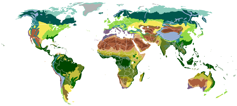
Sign in to savethumb|These maps show a scale, or index of greenness, based on several factors: the number and type of plants, leafiness, and plant health. Where foliage is dense and plants are growing quickly, the index is high, represented in dark green. Regions with sparse vegetation and a low vegetation index are shown in tan. Based on measurements from the Moderate Resolution Imaging Spectroradiometer (MODIS) on NASA's Terra satellite. Areas where there is no data are gray.
Vegetation refers to the plants covering an area of land, which scientists measure using satellite data to assess factors like plant density, leaf coverage, and overall plant health. Understanding vegetation patterns matters because they indicate the biological productivity and environmental conditions of different regions around the world.
AI-generated from the Wikipedia summary — may contain errors.
Wikidata facts
Show 3 more facts
- described by source
- Brockhaus and Efron Encyclopedic Dictionary
- topic has template
- Template:Vegetation
- studied by
- phytosociology
Sources (3)
via Wikidata · CC0
Gallery (8)
Available in 64 languages
- Español
- Français
- Deutsch
- 中文
- 日本語
- Русский
- Português
- Italiano
- العربية
- हिन्दी
- Albanian
- Angika
- Asturian
- Azerbaijani
- Bahasa Indonesia
- Basque
- be_x_old
- Belarusian
Show 45 more
- Bhojpuri
- Bikol
- Bosnian
- Bulgarian
- Catalan
- Chuvash
- Czech
- Danish
- Esperanto
- Estonian
- Filipino
- Greek
- Hebrew
- Hungarian
- Icelandic
- Igbo
- Kannada
- Kazakh
- Kyrgyz
- Latin
- Latvian
- Limburgish
- Lithuanian
- Malagasy
- Malay
- Nederlands
- Norwegian
- Norwegian Nynorsk
- Polski
- Quechua
- Romanian
- Scots
- Serbian
- simple
- Slovak
- Svenska
- Swahili
- Tiếng Việt
- Türkçe
- Ukrainian
- Wu Chinese
- zh_min_nan
- zh_yue
- فارسی
- 한국어
via Wikidata sitelinks · CC0