Category
page 1Glaciology

ice
Ice is water that is frozen into a solid state, typically forming at or below temperatures of 0 °C, 32 °F, or 273.15 K. It occurs naturally on Earth, on other planets, in Oort cloud objects, and as interstellar ice. As a naturally occurring crystalline inorganic solid with an ordered structure, ice is considered to be a mineral. Depending on the presence of impurities such as particles of soil or bubbles of air, it can appear transparent or a more or less opaque bluish-white color.

glacier
thumb|upright=1.2|Glacier of the Geikie Plateau in Greenland
thumb|upright=1.2|The Taschachferner in the Ötztal Alps in [[Austria. The mountain to the left is the Wildspitze (3.768 m), second highest in Austria]]
thumb|upright=1.2|With 7,253 known glaciers, Pakistan contains more glaciers than any other country on Earth outside the polar regions. At in length, the pictured [[Baltoro Glacier is the fifth longest alpine glacier in the world.]]
A glacier (; or ) is a persistent body of natural ice, a form of
rock, that is constantly moving under its own weight. A glacier forms where the accumulat

ice age
period of long-term reduction in temperature of Earth's surface and atmosphere
.jpg)
fjord
thumb|Geirangerfjord, [[Norway]]
In physical geography, a fjord (also spelled fiord, a variant most common in New Zealand English; ) is a long, narrow sea inlet with steep sides or cliffs in a valley created by a former glacier, which has since become inundated with water. They are the glacial equivalent of drowned river valleys, known as rias. Fjords exist on the coasts of Antarctica, the Arctic, and surrounding landmasses of the northern and southern hemispheres. Areas with extensive fjords demonstrate an extreme example of the coastline paradox; Norway's coastline is estimated to be long wi

glaciology
thumb|right|Lateral moraine on a glacier joining the [[Gorner Glacier, Zermatt, Swiss Alps. The moraine is the high bank of debris in the top left hand quarter of the image.]]
thumb|Glaciologist Erin Pettit in Antarctica, 2016|upright
.JPG)
moraine
thumb|right|250px|The snow-free debris hills around the lagoon are lateral and terminal moraines of a valley glacier in [[Manang, Nepal.]]
thumb|right|250px|Moraine of the Nanga Parbat North Face Glacier as seen from [[Fairy Meadows, Pakistan.]]
thumb|Aerial view of the moraine of the Nanga Parbat North Face Glacier.
ice sheet
large mass of glacier ice

loess
thumb|Loess in Vicksburg, Mississippi, United States
.jpg)
nunatak
thumb|Nunataks in Antarctica
thumb|Cântaro Magro, Serra da Estrela, [[Portugal, formed as a nunatak during the last ice age and now exposed.]]
A nunatak (from Inuit ) is the summit or ridge of a mountain that protrudes from an ice field or glacier that otherwise covers most of the mountain or ridge. They often form natural pyramidal peaks. Isolated nunataks are also called glacial islands, and smaller nunataks rounded by glacial action may be referred to as rognons.

cirque
thumb|Two cirques with semi-permanent snowpatches near Abisko National Park, Sweden
thumb|Upper Thornton Lake Cirque in North Cascades National Park, U.S.

abrasion
process of wearing down or wearing away of rocks by the hard particles carried by rivers, glaciers, wind and waves

firn
__NOTOC__
thumb|right|Sampling the surface of a glacier. There is increasingly dense firn between surface snow and blue glacier ice.
thumb|right|Firn field on the top of Säuleck, [[Hohe Tauern, in the Central Alps]]
Firn (; from Swiss German "last year's", cognate with before) is partially compacted névé, a type of snow that has been left over from past seasons and has been recrystallized into a substance denser than névé. It is ice that is at an intermediate stage between snow and glacial ice. Firn has the appearance of wet sugar, but has a hardness that makes it extremely resistant to shovel

Cryogenian
The Cryogenian (from , meaning "cold" and , romanized: , meaning "birth") is a geologic period that lasted from . It is the second of the three periods of the Neoproterozoic era, preceded by the Tonian and followed by the Ediacaran.

U-shaped valley
valleys formed by glacial scouring

drumlin
thumb|Drumlins around Horicon Marsh, Wisconsin, in an area with one of the highest concentration of drumlins in the world. The curved path of the [[Laurentide Ice Sheet is evident in the orientation of the various mounds.|380px]]
thumb|Elongate and Magellanic subpolar forests|forested drumlins south of [[Puerto Williams, Chile. Flow direction here was at time of formation from west to east (left to right on picture).]]

pingo
thumb|Ibyuk pingo near Tuktoyaktuk, northern Canada
thumb|View from top of a pingo towards another, within a partly drained lake, the Arctic Ocean in the background (near Tuktoyaktuk). July 20, 1975.

glacial period
interval of time within an ice age that is marked by colder temperatures and glacier advances

crevasse
thumb|right|upright=1.3|Transverse crevasses, Chugach State Park, Alaska
A crevasse is a deep crack that forms in a glacier or ice sheet. Crevasses form as a result of the movement and resulting stress associated with the shear stress generated when two semi-rigid pieces above a plastic substrate have different rates of movement. The resulting intensity of the shear stress causes a breakage along the faces.
ice core
core sample of ice, typically removed from a glacier or ice sheet
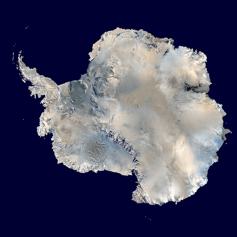
Antarctic ice sheet
polar ice cap

till
thumb|right|Closeup of glacial till. Note that the larger grains (pebbles and gravel) in the till are completely surrounded by the matrix of finer material (silt and sand), and this characteristic, known as matrix support, is diagnostic of till.
thumb|right|Glacial till with tufts of grass
thumb|Till after avalanche, Norway
Till, or glacial till, is unsorted glacial sediment.

polynya
thumb|Coastal polynyas are produced in the Antarctic by katabatic winds
thumb|Katabatic wind spilling off an ice shelf|upright
thumb|A frosty Arctic condensation plume marks this polynya near the west shore of Hudson Bay. This one (and others nearby) are likely kept open by tidal currents. Mile-high west-facing aerial view.

kame
thumb|A kame near Kirriemuir, Scotland
thumb|A kame in Yellowstone National Park, Wyoming
thumb|A kame among the glacial drift on the [[terminal moraine of the Okanagan Lobe of the Cordilleran Ice Sheet on the Waterville Plateau of the Columbia Plateau in Washington]]
A kame, or knob, is a glacial landform, an irregularly shaped hill or mound composed of sand, gravel and till that accumulates in a depression on a retreating glacier, and is then deposited on the land surface with further melting of the glacier. Kames are often associated with kettles, and this is referred to as kame and kettle
post-glacial rebound
rise of land masses that were depressed by the huge weight of ice sheets during the last glacial period
outwash plain
plain formed from glacier sediment that was transported by water.
Last Glacial Maximum
most recent glacial maximum during the last glacial period
retreat of glaciers since 1850
Shortening of glaciers by melting of their ice in warmer locations
giant's kettle
cavity or hole which appears to have been drilled in the surrounding rocks by eddying currents of water bearing stones, gravel and other detrital matter
Huronian glaciation
severe glaciation during the Paleoproterozoic Era, possibly due to the Oxygen catastrophe, leading to a "Snowball Earth"
ablation zone
low-altitude area of a glacier
kettle
shallow depression formed by a retreating glacier
core sample
cylindrical section of a naturally occurring substance, usually obtained by drilling into it with special drills
Marine isotope stage
alternating warm and cool periods in the Earth's paleoclimate, deduced from oxygen isotope data

jökulhlaup
thumb|300x300px|A jökulhlaup
thumb|300x300px|The impounded lake a month earlier, before the same jökulhlaup
A jökulhlaup ( ) (literally "glacial run") is a type of glacial outburst flood. It is an Icelandic term that has been adopted in glaciological terminology in many languages.
It originally referred to the well-known subglacial outburst floods from Vatnajökull, Iceland, which are triggered by geothermal heating and occasionally by a volcanic subglacial eruption, but it is now used to describe any large and abrupt release of water from a subglacial or proglacial lake/reservoir.
Arctic ice pack
sea ice cover of the Arctic Ocean and its vicinity

serac
thumb|Fox Glacier, New Zealand
fast ice
sea ice that is immobile due to its attachment to a coast, usually extending offshore to about the 20-m isobath
tunnel valley
U-shaped valley originally cut by water under the glacial ice near the margin of continental ice sheets
Penitentes
Field of regularly spaced ice formations formed by sublimation at high altitudes

palsa
300px|thumb|upright=1.4|A group of well developed palsas as seen from above
Palsas are peat mounds with a permanently frozen peat and mineral soil core. They are a typical phenomenon in the polar and subpolar zone of discontinuous permafrost. One of their characteristics is having steep slopes that rise above the mire surface. This leads to the accumulation of large amounts of snow around them. The summits of the palsas are free of snow even in winter, because the wind carries the snow and deposits on the slopes and elsewhere on the flat mire surface. Palsas can be up to in diameter and can re
pressure ridge
ridge formed in pack ice by accumulation of ice blocks in the convergence between floes
ice congestion
accumulation of ice on a river caused by ice break-up forming a barrier that in turn can cause floods
frost heaving
results from ice forming beneath the surface of soil during freezing conditions

bergschrund
thumb|x180px|alt=Refer to caption|Cross section of a cirque glacier showing the bergschrund
thumb|upright=1.3|alt=Three mountaineers on a snow-covered icefield with mountain peaks in the distance|A bergschrund—the long crack at the foot of the mountain slope—in the Ötztal Alps
thumb|alt=Rocky peaks protruding from undulating ice masses|Open bergschrunds at Mont Dolent
A bergschrund (from the German for mountain cleft; sometimes abbreviated in English to "schrund") is a crevasse that forms where moving glacier ice separates from the stagnant ice or firn above. It is often a serious obstacle for

aufeis
thumb|upright|Laminations of ice in a sheet of aufeis
Aufeis ( ) (German for "ice on top") is a sheet-like mass of layered ice that forms from successive flows of ground or river water during freezing temperatures. This form of ice is also called overflow, icings, or the Russian term, naled (). The term "Aufeis" was first used in 1859 by Alexander von Middendorff following his observations of the phenomenon in northern Siberia.
Yoldia Sea
Baltic Sea predecessor in the Pleistocene epoch
moulin
well-like shaft within a glacier
Karoo Ice Age
glaciation
blue ice
form of ice formed under high pressure in a glacier
ice calving
breaking of ice chunks from the edge of a glacier

periglacial process
thumb|Example of a periglacial landscape with both pingos and polygon wedge ice near [[Tuktoyaktuk, Northwest Territories, Canada]]
rock glacier
landform of angular rock debris frozen in interstitial ice, former "true" glaciers overlain by a layer of talus, or something in between
Marinoan glaciation
glaciation
dead ice
Glacial ice which is no longer moving

meltwater
thumb|Meltwater in early spring in Kinney Run|a stream in Pennsylvania, USA
thumb|right|Meltwater from Mount Edith Cavell Cavell Glacier
thumb|right|Meltwater transfer from sea ice surface [[melt ponds to the ocean during MOSAiC Expedition ]]
Meltwater (or melt water) is water released by the melting of snow or ice, including glacial ice, tabular icebergs and ice shelves over oceans. Meltwater is often found during early spring when snow packs and frozen rivers melt with rising temperatures, and in the ablation zone of glaciers where the rate of snow cover is reducing. Meltwater can be produce

dropstone
thumb|300px|A dropstone of quartzite in layered [[rhythmite at Itu, Brazil]]
Dropstones are isolated fragments of rock found within finer-grained water-deposited sedimentary rocks or pyroclastic beds. They range in size from small pebbles to boulders. The critical distinguishing feature is that there is evidence that they were not transported by normal water currents, but rather dropped in vertically through the air or water column, such as during a volcanic eruption.
Holocene glacial retreat
Global deglaciation
Laurentide Ice Sheet
continental glacier in North America during the last ice age
glacier morphology
geomorphology of glaciers
Ice lens
formation of moisture, diffused within soil or rock, which accumulates in a localized zone