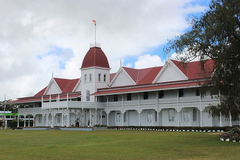
Nukuʻalofa
Nukualofa ( , ) is the capital and largest city of Tonga. It is located on the north coast of the island of Tongatapu, in the country's southernmost island group.
AI overview
Nukuʻalofa is the capital and largest city of Tonga, a South Pacific island nation. Located on the northern coast of Tongatapu island, it serves as the country's main urban center and seat of government.
AI-generated from the Wikipedia summary — may contain errors.
Weather now
cached 2h ago24°overcast clouds
62% 4.2 m/s OpenWeatherMap
7-day forecast
via Open-Meteo
Place details
- Locality
- Nukuʻalofa
- Region
- Tongatapu
- Country
- Tonga
- Population
- 22,400
Article
12 sectionsContents
- History
- First western records of Nuku{{fakau'a}}alofa
- Capital of the Kingdom of Tonga (1875 and later)
- 21st century
- Government
- Climate
- Economy
- Transport
- Twin towns – sister cities
- Endnotes
- References
- External links
Cook never used the name Nukualofa or any alternative spelling for the reports of this voyage, but he mentioned the island of Pangaimodoo (Pangaimotu) which was to the east of his anchorage position. Captain Cook also wrote that he travelled by canoes to visit Mooa (Mua) where Paulaho and other great men lived. The house that Paulaho provided was on the beach from the ship. Reference to his map shows that he must have landed and stayed in the Siesia area, the eastern part of modern Nukualofa. Cook also drafted the first map of the bay of Nukuʻalofa.
thumb|left|300px|The first recorded Map of Tongataboo Harbour as sketched by Captain Cook in 1777. The map clearly shows the Bay of Nukuʻalofa and his anchored position near Pangaimotu. Small islands of Nukuʻalofa were named with phonetic spelling, including Atata, Pangaimotu, Makahaʻa, and Fetoa.