Weather now
cached 17h ago27°broken clouds
92% 0.9 m/s OpenWeatherMap
7-day forecast
via Open-Meteo
Place details
- Locality
- မြစ်ကြီးနားမြို့
- Region
- ကချင်ပြည်နယ်
- Country
- မြန်မာ
- Population
- 90,894
Travel guide
Understand
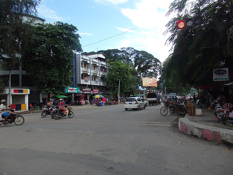
Although today a sleepy backwater, Myitkyina was the site of a bitter battle between Japanese and Allied forces during the Second World War. The town was almost completely destroyed in the battle. The location of the town, in an opportunistic valley between India and China, made it strategic enough to be on the Ledo Road built by the US General Joseph Stilwell. Myitkyina could, one day, become an important way station for trade between the two Asian giants, India and China. For now, Myitkyina is a destination because of the journey. There is no road or river connection to Bhamo due to conflicts between "rebels" and the army south of the city) and because it is a staging point for trips to Indawgyi Lake and Putao (Jun 2012).
The best time to visit is in late Oct-early Feb.
Get around
Myitkyina is small. You can get anywhere in the city by trishaw or by walking.
If you arrive by train, turn left and walk along the main street to get to the city centre. After reaching an intersection with a clock tower, turn right and left to go to New Light Hotel, or left and right for the YMCA.
As of February 2018 foreigners are still barred from river or overland travel to Bhamo To reach Bhamo there is only one flight a week, Myanmar Air leaving at 1 pm Monday's. The flight is only 25 minutes and as of February 2018 the cost was $86 USD with taxes and travel agent fees. Other option is to travel to Katha and travel up river by boat.
Tuk tuk to the airport (10 minutes from the city) will be around 3,000-4,000 kyat.
Do
Visit the memorial dedicated to the Chinese Expeditionary Forces.
Buy
One can find and buy the world's best jade and gems. Buy Kachin traditional dresses, handicrafts, and other national cultural textiles and food.
Go next
Myitson (Mali Zup in Kachin language), the confluence of Mali and Nmai Rivers and the starting point of the Irrawady River, 32 km from Myitkyina Indawgyi Lake
Travel guide from Wikivoyage (CC BY-SA 4.0)
Article · 中文
密支那(緬甸語:မြစ်ကြီးနားမြို့,緬甸語發音:[mjɪʔtɕíná],缅甸语委转写:mrac kri: na: mrui.;景颇语:Myitkyina)是缅甸克钦邦的首府,距仰光1479公里,距曼德勒784公里。密支那坐落於伊洛瓦底江边,伊洛瓦底江两条支脉东支恩梅开江和西支迈立开江的汇流处(密松)的下游,在缅甸语中,密支那意为“大河之滨”。 密支那,原名為“斯那公”(又稱“三拉公”),为“绅士”之意。在密支那这座历史名城和文化名城里,随处可见金碧辉煌的寺院和佛塔。第二次世界大戰期間密支那曾被日軍及緬甸共產黨翁山將軍佔領。1944年5月,在中美聯軍史迪威將軍及副指揮鄭洞國策劃下,中國遠征軍由印度發起反攻,新一軍新三十八師、、麥瑞爾突擊隊數千戰士空降密支那機場,歷經三個月圍城血戰,死傷數千戰士,最後攻入城中心火車站,戰爭方才結束。日軍3000多人幾乎全數陣亡。美軍3000多名士兵當中272人陣亡,2000多人受傷;中國遠征軍則傷亡六千餘人,分別葬於城北和城南三處墓地。
Abstract from DBpedia / Wikipedia · CC BY-SA
Gallery (10)
On the map
6 mapped locations